Hello,
I'm
Satyam Shah
|
Let's Connect
About Me


Academic Background
-
Master’s Degree 🎓 Distinction

University of Leicester
Master of Science, Geographical Information Science (GIS)
-
Gatsby Plant Science Summer Program

University of Cambridge
-
Bachelor’s Degree
University of Leicester
Bachelor of Science, Biological Sciences (Zoology)
Professional Background
-
Earth Observation Intern

Space Park Leicester (SPL), United Kingdom
-
KTP Project Contributor

Bluesky International Limited, United Kingdom
-
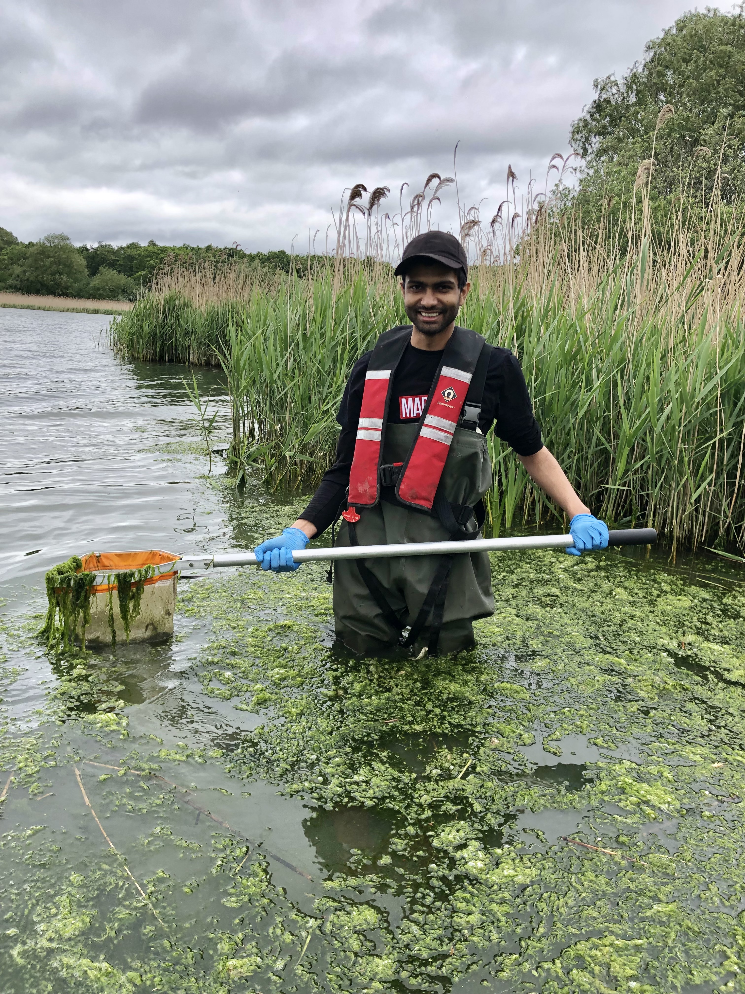
Remote Sensing Expert

Carbon Keepers, United Kingdom
-
Student Research Assistant

National Forest, United Kingdom
-
Biodiversity Consultant
University of Leicester, United Kingdom
Skills
GIS & Remote Sensing
Google Earth Engine

ArcGIS Pro
ArcGIS Online

QGIS

eCognition
 (20).png)
Remote Sensing
 (19).png)
Web Cartography

ERDAS IMAGINE

ENVI
Leaflet

Mapbox
Folium
Programming & Scripting
Python
JavaScript
R
Node.js
LaTeX
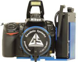
Geomatics & Surveying
Total Station
GNSS/GPS
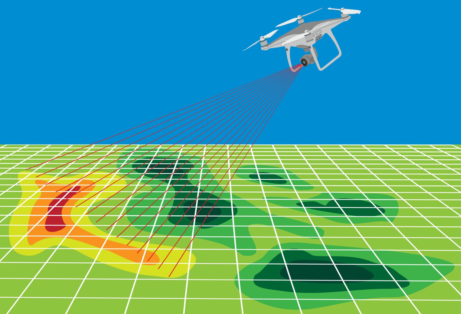
UAV/Drone
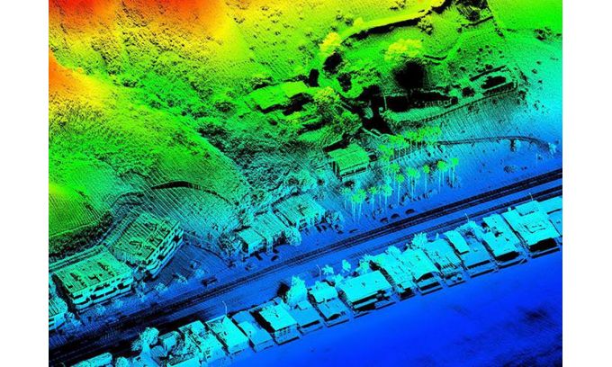
LiDAR/TLS
SfM Photogrammetry

Pix4D

CloudCompare

OpenDroneMap

Agisoft Metashape
3D Reconstruction

Surfer
MeshLab
Data Visualization & Analysis

Power BI
 (21).png)
Streamlit
Tableau
Matplotlib
Plotly

Pandas
NumPy
SciPy
Machine Learning & AI

ML/AI

Prompt Engineer
TensorFlow
PyTorch
Keras
scikit-learn
Databases

PostgreSQL
MySQL

MongoDB
DuckDB
Cloud Platforms
AWS

Google Cloud
Azure
Projects
Remote Sensing & Computer Vision
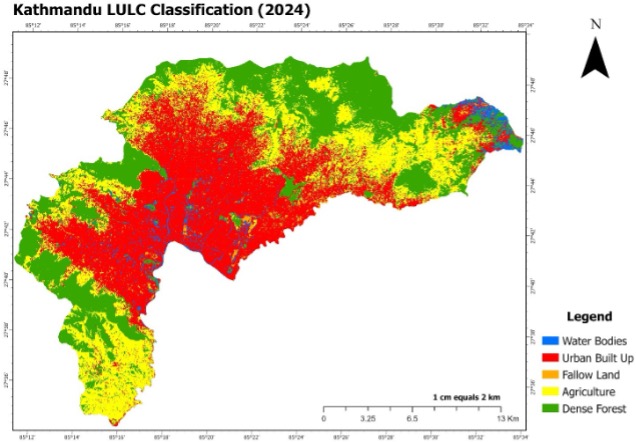
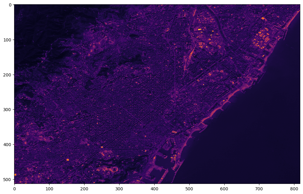
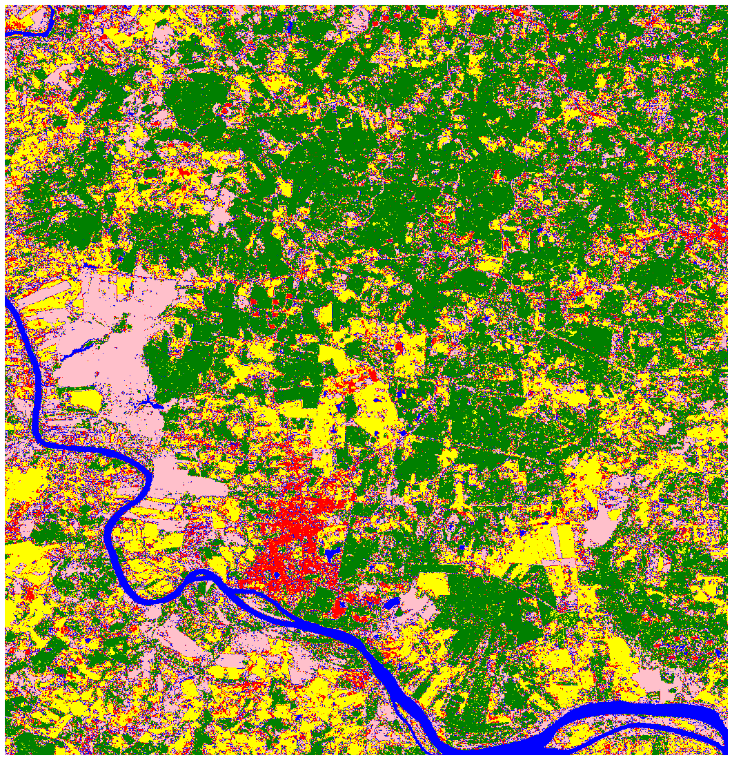
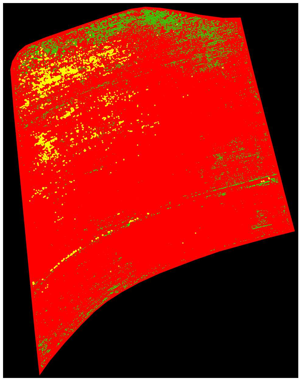
LULC Temporal Dynamics of Kathmandu City
Remote Sensing
This model aims to analyze the correlation between vegetation and bare soil areas and also cloud percentage during 1st January 2018 – 1st January 2019.
Read more
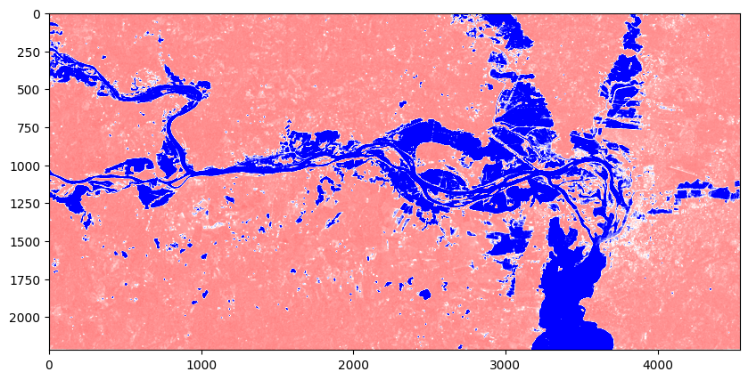
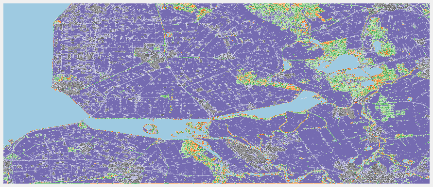
Flood Detection with Sentinel-1
Adv. Remote Sensing
The project shows the implementation of Sentinel-1 data for flood detection.
Read more
Watershed-Based Tree Segmentation
Adv. Remote Sensing
This project involves analyzing intensity features of the image to identify regions of interest and separating them into different regions.
Read more
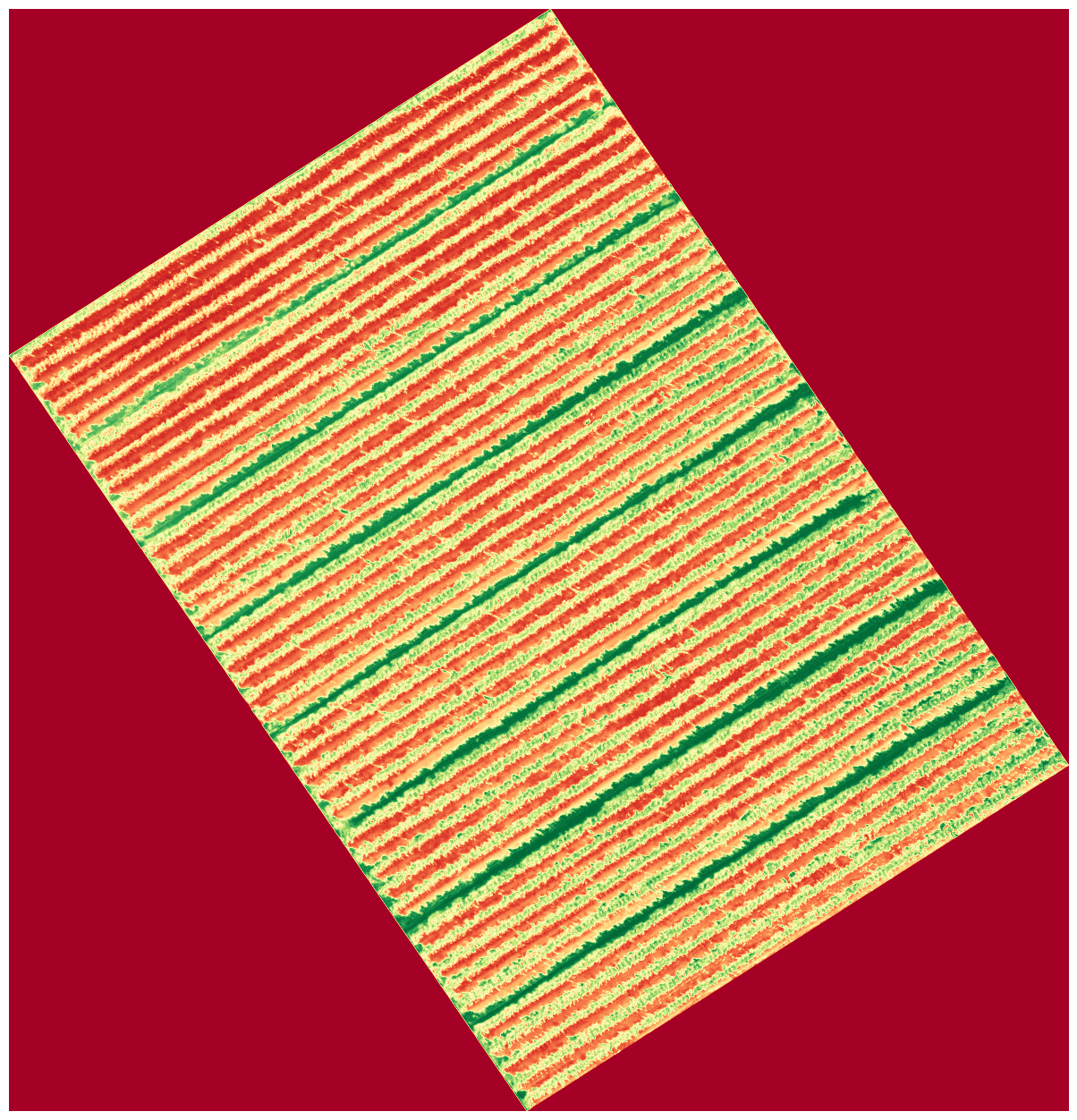
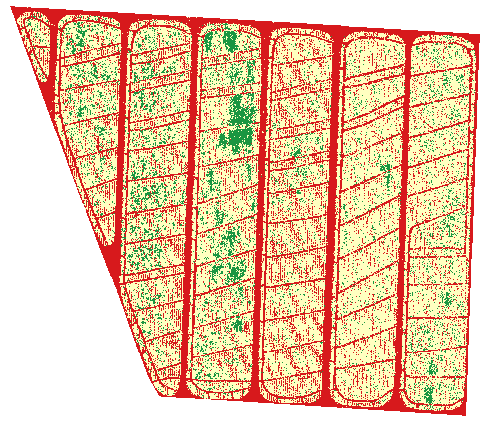
Detection of Crop Lines with Hough Line Transform
Adv. Remote Sensing
This project showcases the use of Hough Line Transform algorithm to detect crop lines.
Read more
Using SAM and GEOBIA to Classify Vineyard
Adv. Remote Sensing
This project makes use of the Segment Anything Model (SAM) and GEOBIA for vineyard classification.
Read more
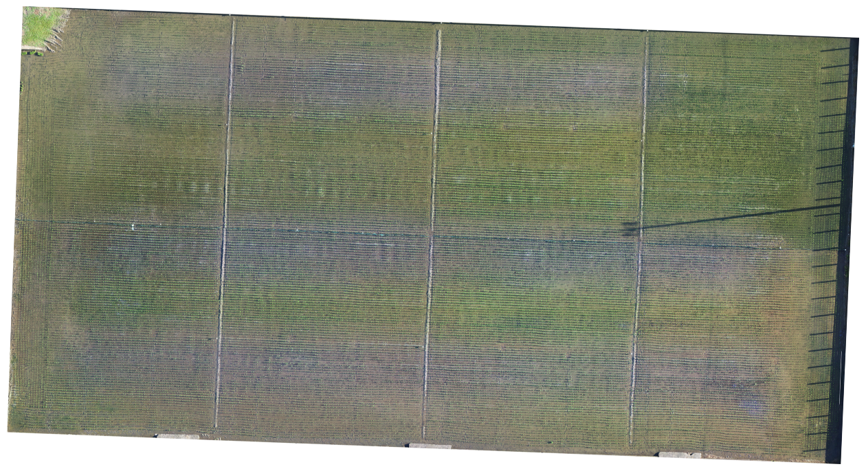
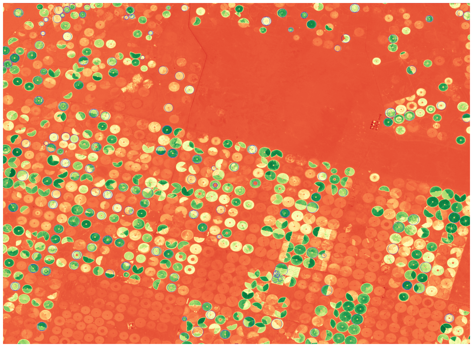
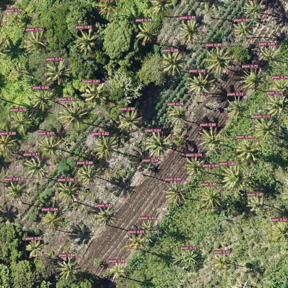
Using Computer Vision Algorithms for Plant Detection and Counting
Adv. Remote Sensing
This project integrates CV algorithms for efficient detection and quantitative analysis of plant populations
Read more
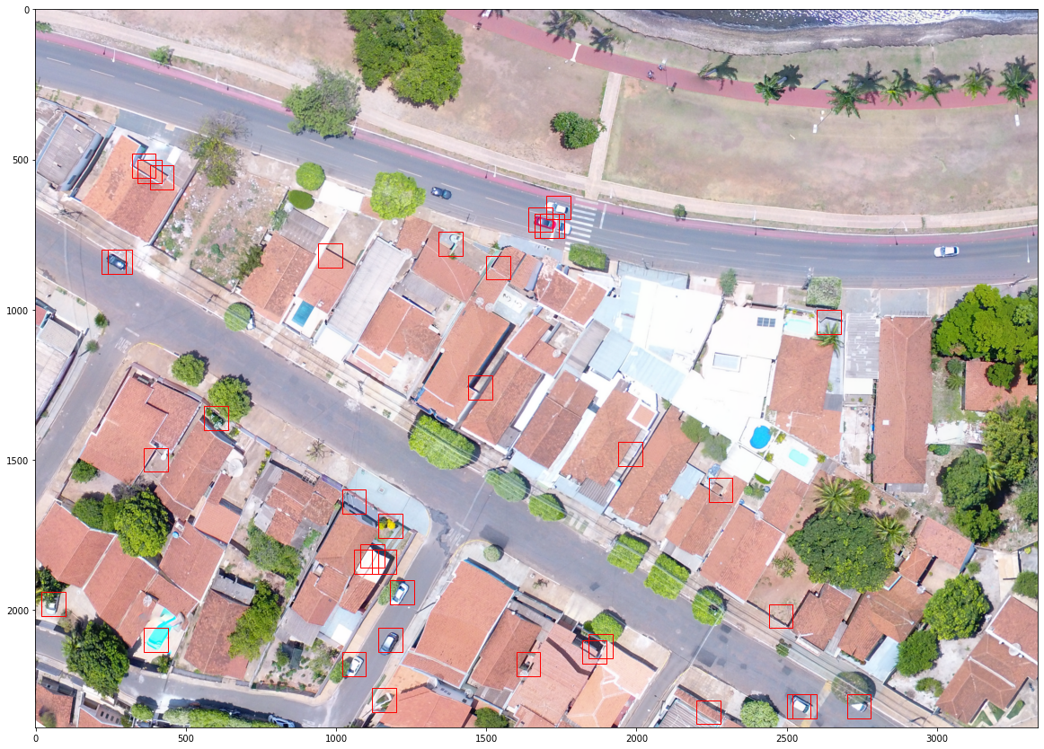
Template Matching on OpenCV to Detect Cars
Adv. Remote Sensing
This project applies object detection CV algorithm to detect cars.
Read more
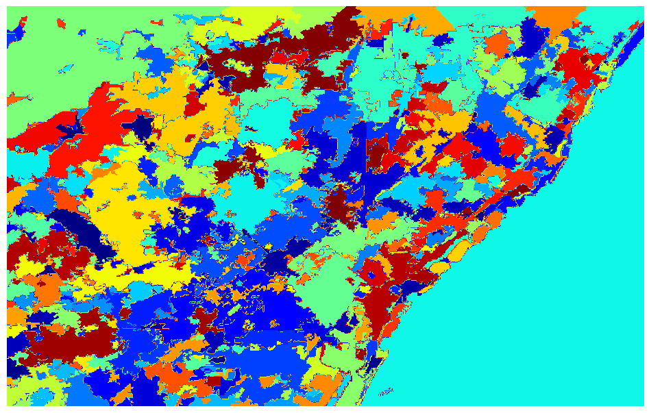
LULC of Netherlands using ML
Adv. Remote Sensing
This project applies HOG and SVM techniques integrated with OBIA for LULC classification.
Read more
PCA-Based Unsupervised Change Detection
Adv. Remote Sensing
This project applies PCA-based unsupervised classification to distinguish spectral patterns and reduce data dimensionality.
Read more
Texture Analysing using GLCM
Adv. Remote Sensing
This project performs texture analysis using the (GLCM) to extract spatial pattern features from imagery.
Read more
Edge Detection using HLT
Adv. Remote Sensing
This project applies HCD and the Probabilistic Hough Line Transform to extract key features and linear structures for precise feature identification.
Read more
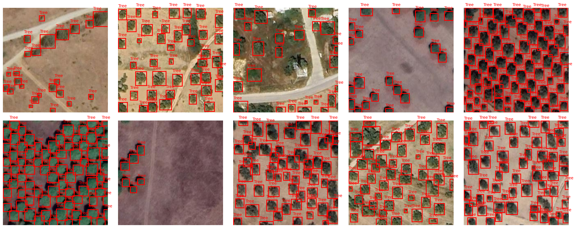
Tree Detection with YOLOv12
Adv. Remote Sensing
This project uses YOLOv12 for tree detection showcasing a DL approach for accurate identification of individual trees.
Read more
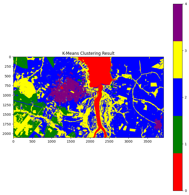
Using Alpha Earth Embeddings for Clustering
Adv. Remote Sensing
This project leverages AlphaEarth embeddings to perform spatial clustering.
Read more
LULC Pixel Classification
Adv. Remote Sensing
This project performs LULC pixel-level classification using Google Alpha embeddings.
Read more
Semantic Segmentation for Coverage Mapping
Adv. Remote Sensing
This project implements semantic segmentation using PyTorch & TorchGeo to generate detailed land usage and coverage maps.
Read more
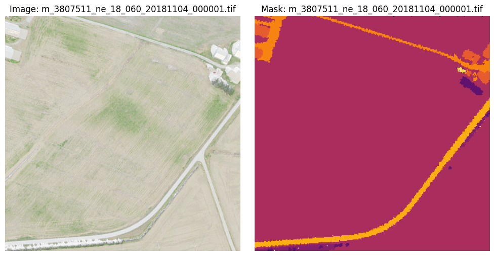
Semantic Segmentation using CNN
Adv. Remote Sensing
This project applies a CNN for semantic segmentation to perform pixel-level mapping.
Read more
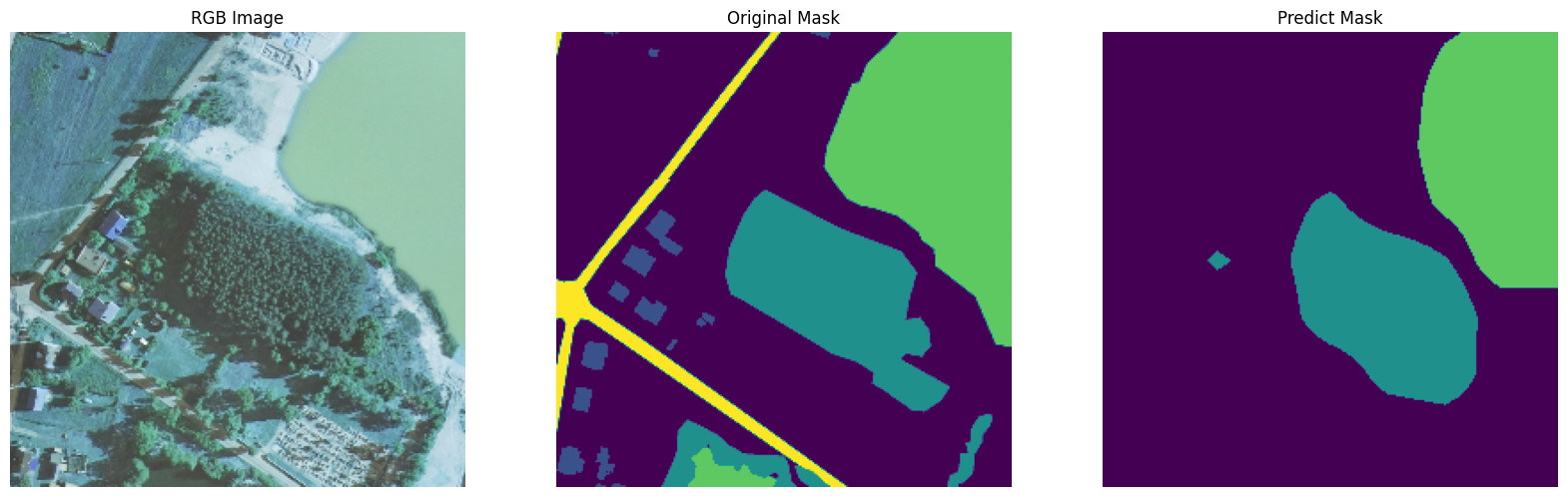
U-Net for Semantic Segmentation & LULC Mapping
Adv. Remote Sensing
This project applies a U-Net architecture for semantic segmentation to perform pixel-level LULC mapping.
Read more
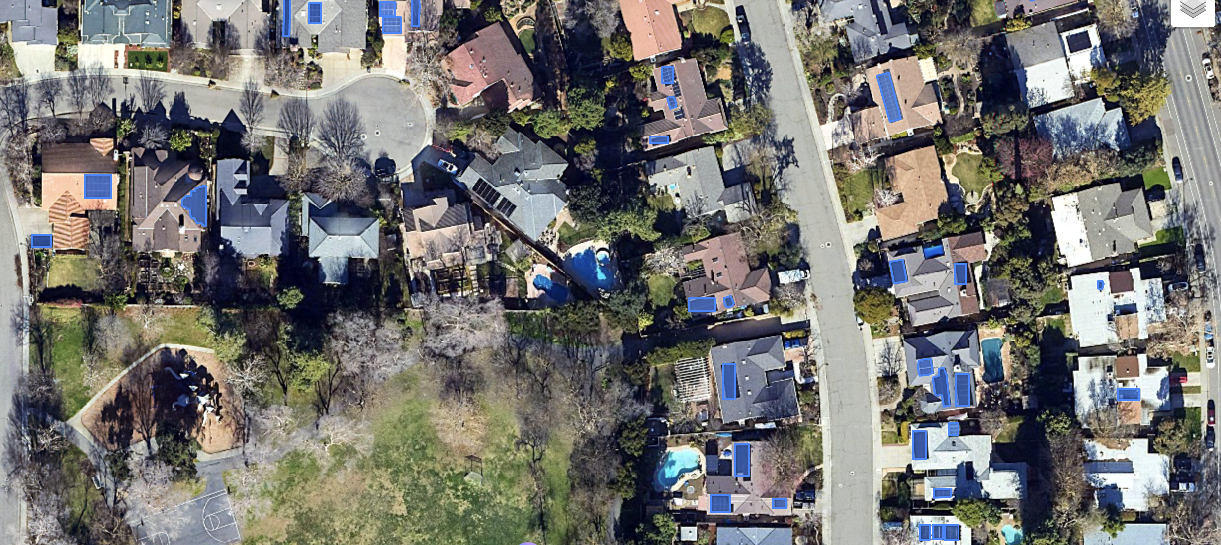
Training Model for Solar Panel Detection
Adv. Remote Sensing
This project focuses on training DL model for solar panel segmentation and delineation of solar panels.
Read more
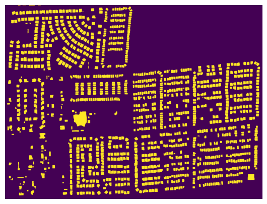
Training Model for Building Segmentation
Adv. Remote Sensing
This project focuses on training DL model for building footprints segmentation.
Read more
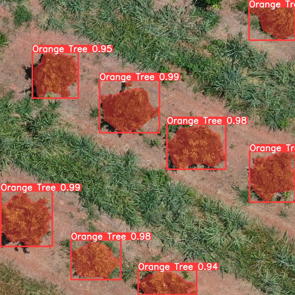
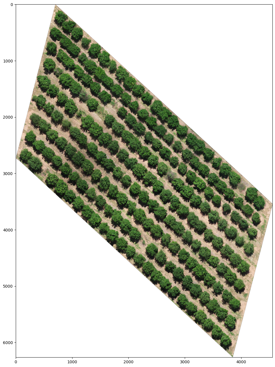
DL-Based Orange Tree Detection
Adv. Remote Sensing
This project performs instance segmentation of orange trees and cars in aerial imagery using YOLOv8 with OBB.
Read more
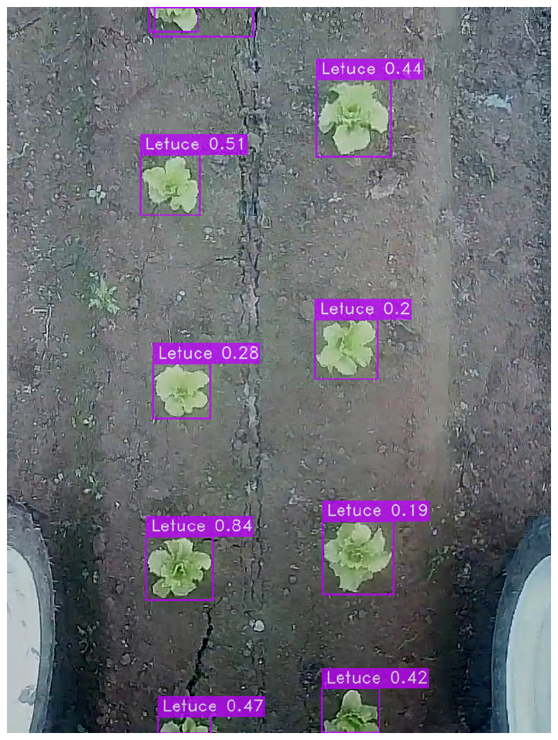
Using YOLO to Detect Vegetables
Adv. Remote Sensing
This project implements a YOLO-based object detection pipeline to identify and count individual vegetable plants in high-resolution field imagery.
Read more
Using YOLO to Detect Trees
Adv. Remote Sensing
This project makes use of YOLO algorithms to detect various objects.
Read more
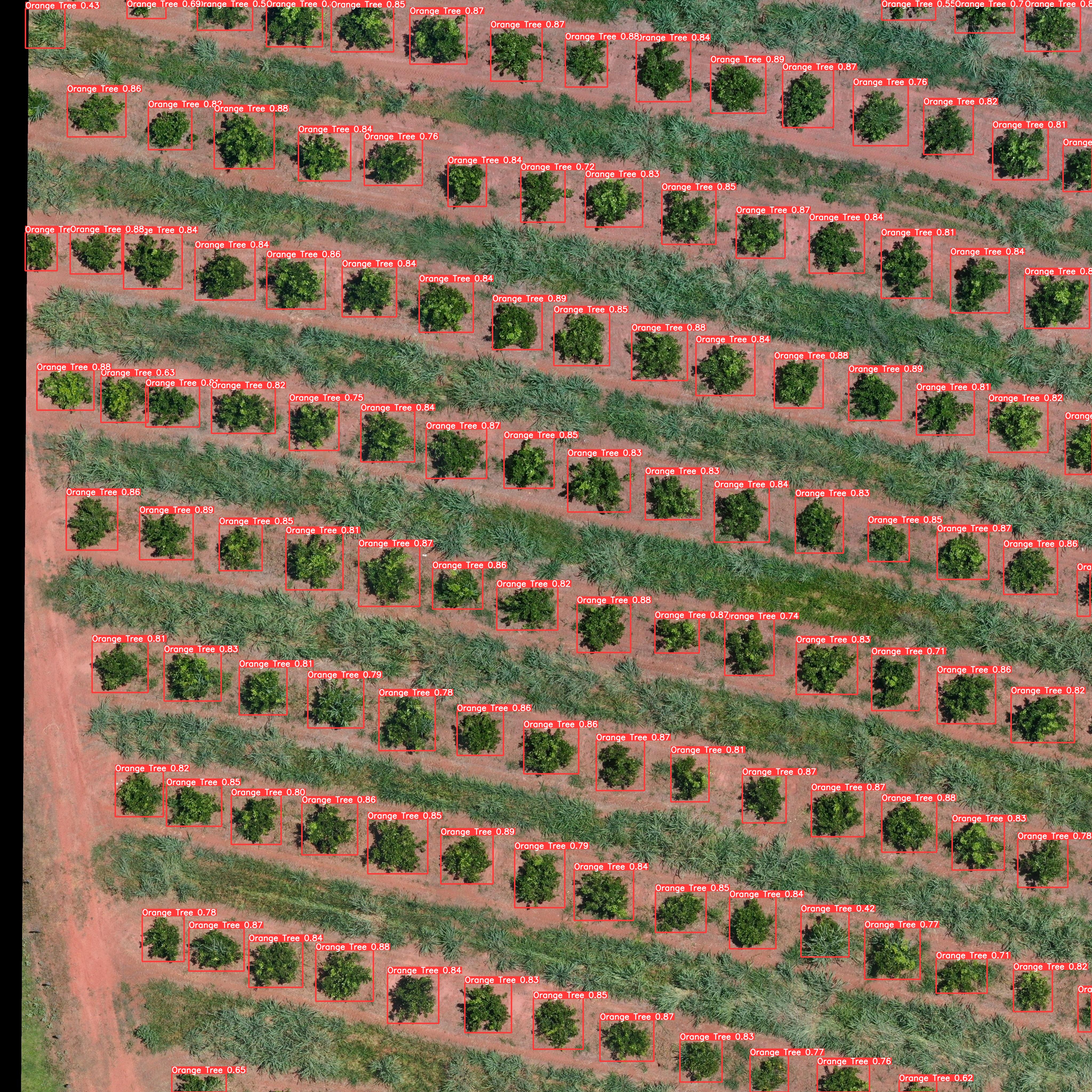
Using YOLOv5 to Detect Orange Trees
Adv. Remote Sensing
This project compares YOLOv5 and SSD, two high-speed, single-shot object detection models, for orange tree-detection.
Read more
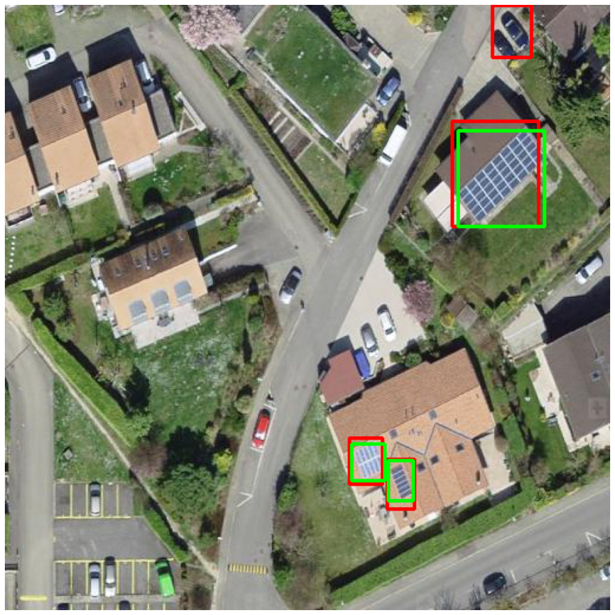
Detection of Solar Panels using Faster RCNN
Adv. Remote Sensing
This project employs a Faster R-CNN architecture to accurately detect solar panels in high-resolution aerial imagery, enabling large-scale renewable energy mapping and monitoring.
Read more
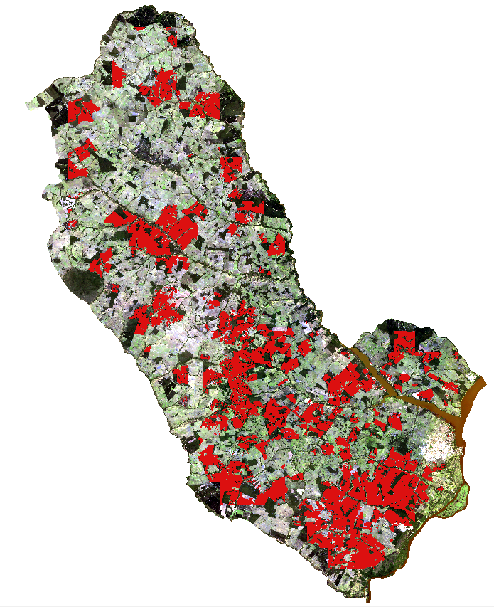
Segmentation of Eucalyptus Zones in Eastern Mato
Adv. Remote Sensing
This project uses a U-Net DL model for semantic segmentation of multispectral satellite imagery to map and delineate eucalyptus plantations.
Read more
Using DeepLabV3+ To Segment Cana Weeds
Adv. Remote Sensing
This project employs the DeepLabv3 model for semantic segmentation to accurately delineate cana weed patches in agricultural fields.
Read more
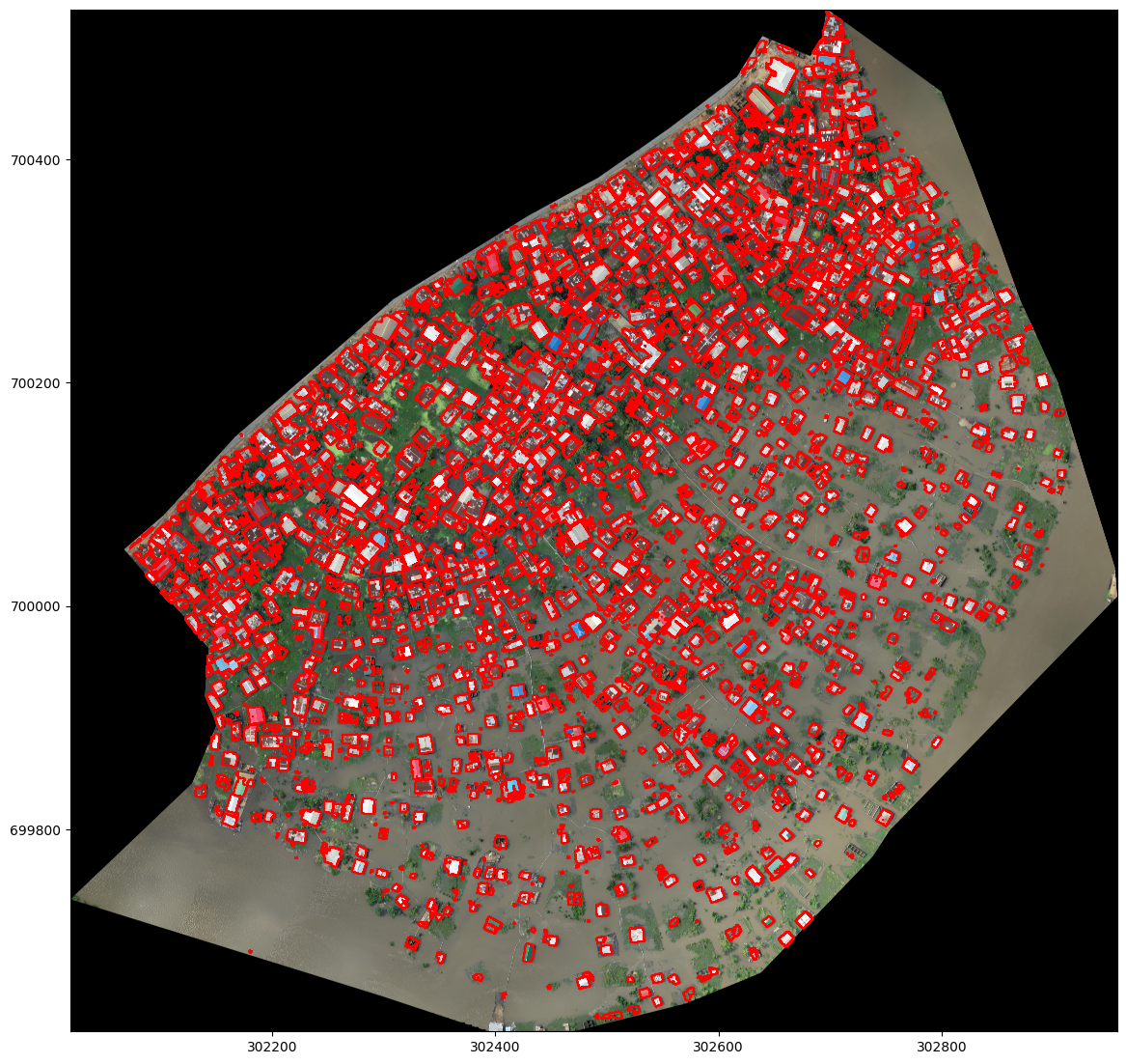
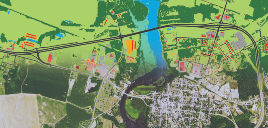
Semantic Segmentation of Building and Houses
Adv. Remote Sensing
This project utilizes DL for the semantic segmentation of buildings in high-resolution aerial imagery.
Read more
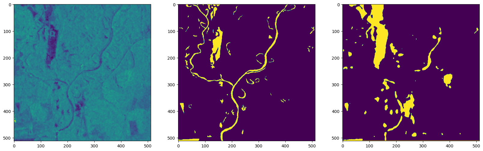
Using U-Net to Segment River Lines and Bodies
Adv. Remote Sensing
This project utilizes a U-Net architecture for the semantic segmentation of rivers from satellite imagery, enabling accurate hydrological mapping.
Read more
Weed Classification in UAV Images with CNN
Adv. Remote Sensing
This project uses (CNNs) for weed classification in high-resolution drone imagery, enabling precise species identification.
Read more

Detection and Classification of Cars from Aerial Imagery
Adv. Remote Sensing
This project employs DL model to detect and classify cars in high-resolution aerial imagery.
Read more
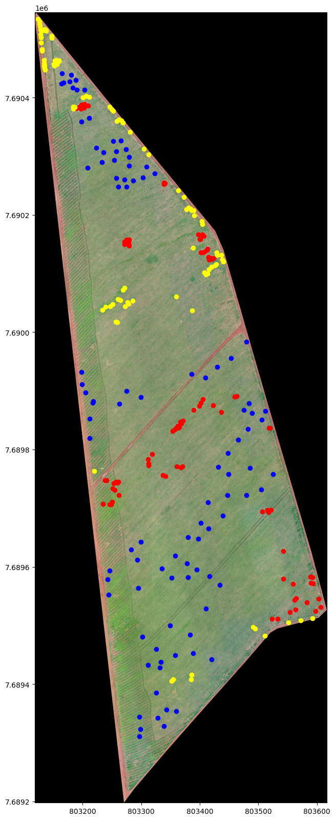
Mapping Vegetation & Weeds with ANN
Adv. Remote Sensing
This project applies an ANN for mapping vegetation and weeds from imagery, performing pixel-level classification to distinguish crop areas from weed-infested regions.
Read more
Pixel Classification with ANN
Adv. Remote Sensing
This project uses an (ANN) to perform pixel-level classification of satellite imagery, enabling automated and accurate land cover mapping.
Read more
Geospatial Data Analytics
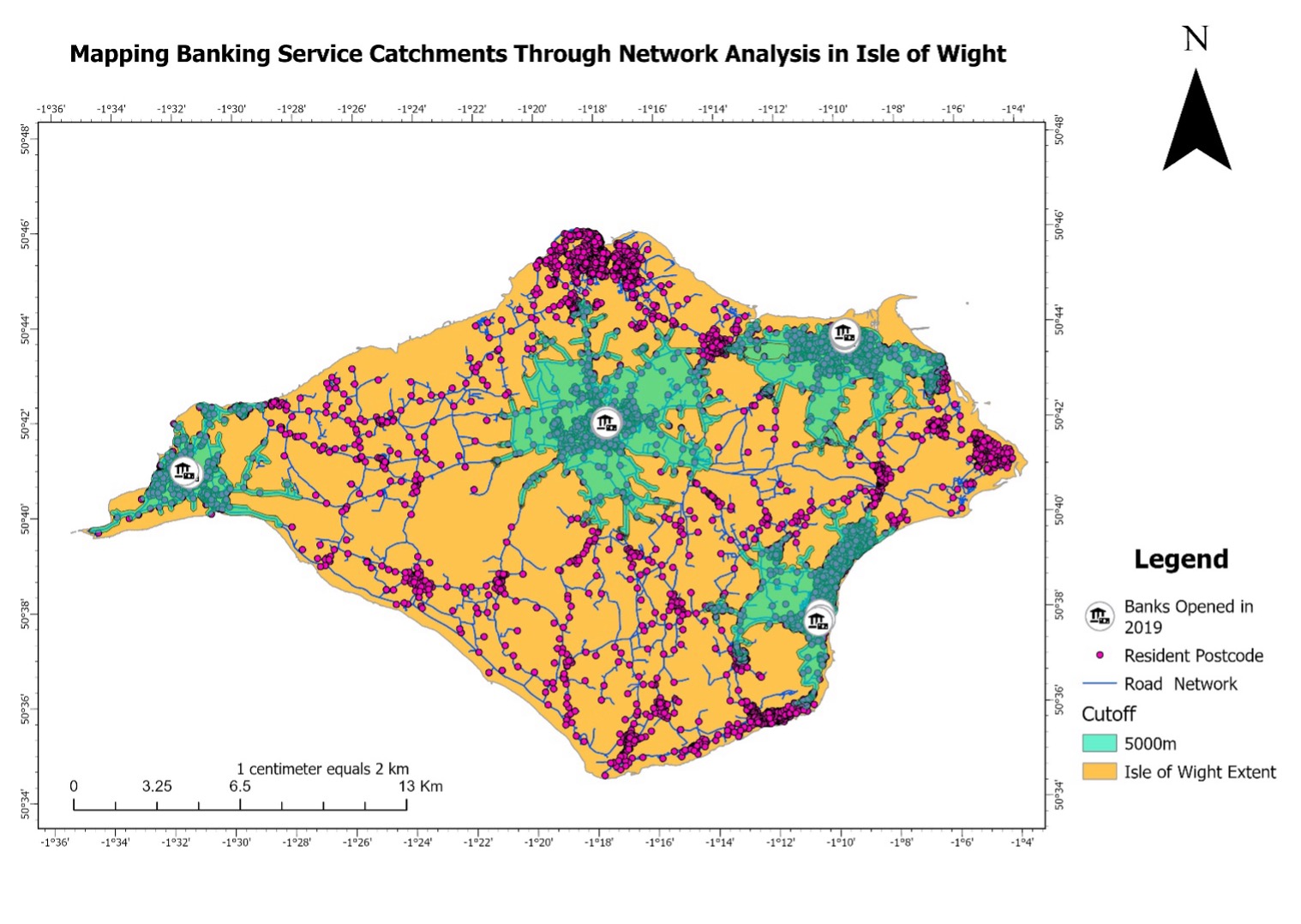
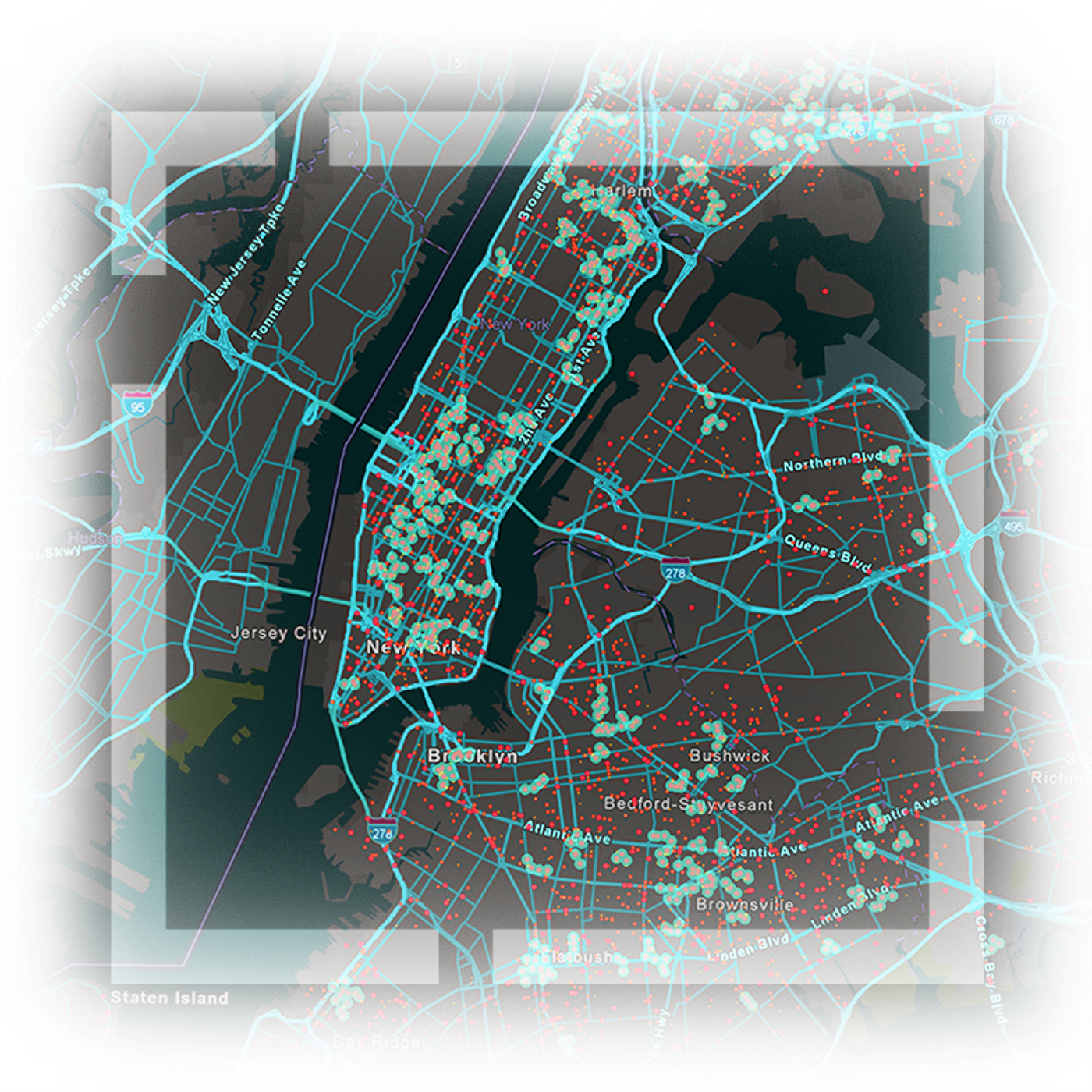
Banking Accessbility Network Analysis
Spatial Analytics
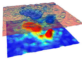
This dashboard shows the visualization of predator-prey ecological dynamics between Red Fox and Ground-Nesting Skylark.
Read more
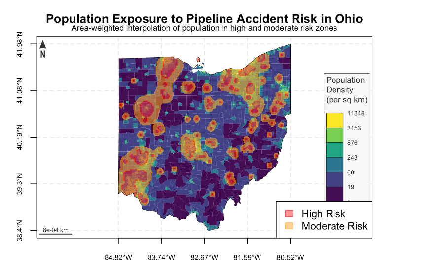
Pipeline Proximity Accidents Analysis
Advanced Spatial Analysis
This project analyzes accidents occurring in proximity to pipeline infrastructure across Ohio to identify high-risk areas.
Read more
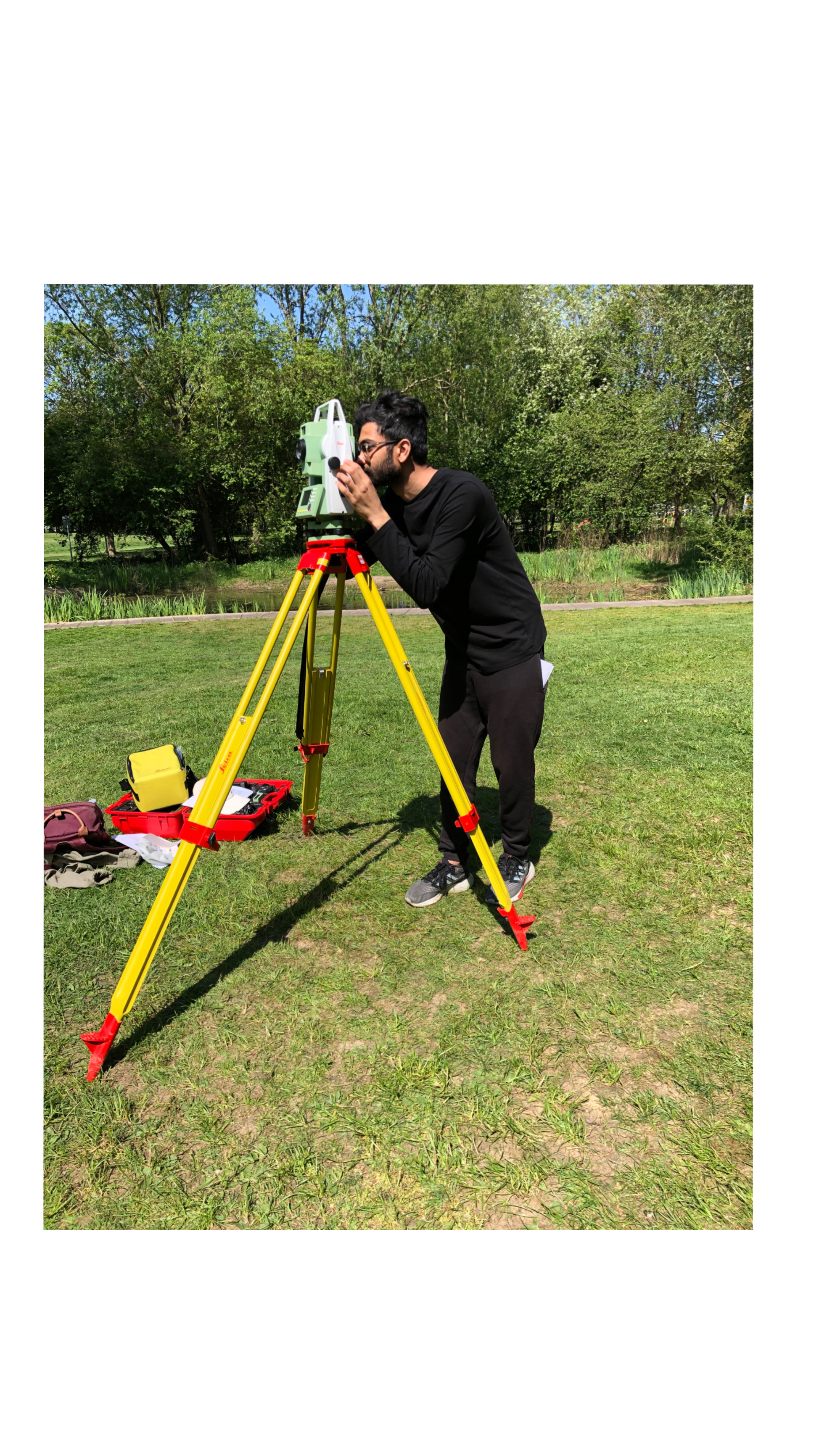
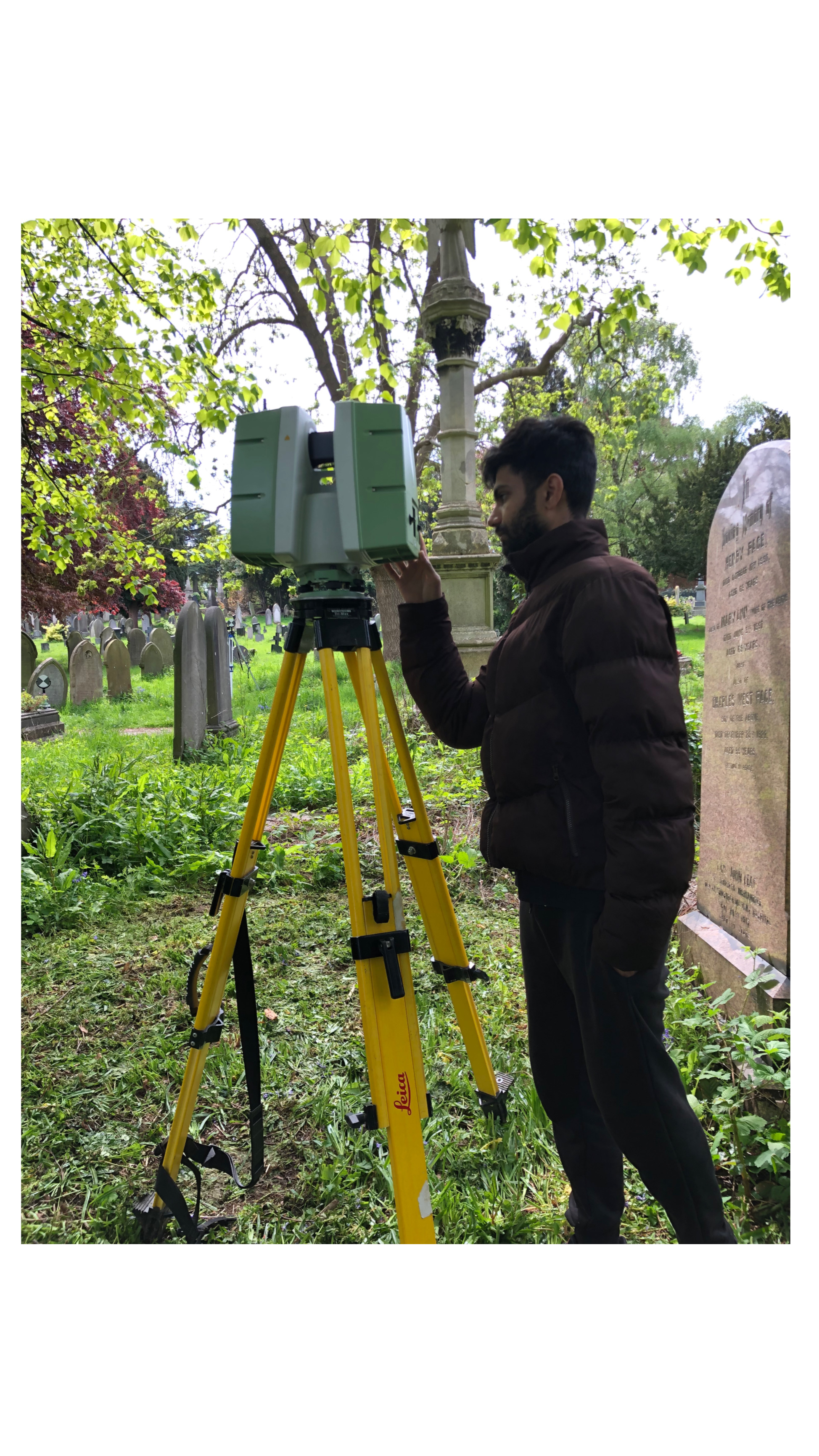
Survey Data Analysis
Geomatics Surveying
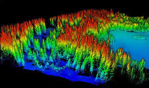
This project leverages a range of modern geomatics tools, including the analysis of point cloud data from LiDAR, TLS, and aerial photogrammetry, to perform detailed spatial analysis.
Read more
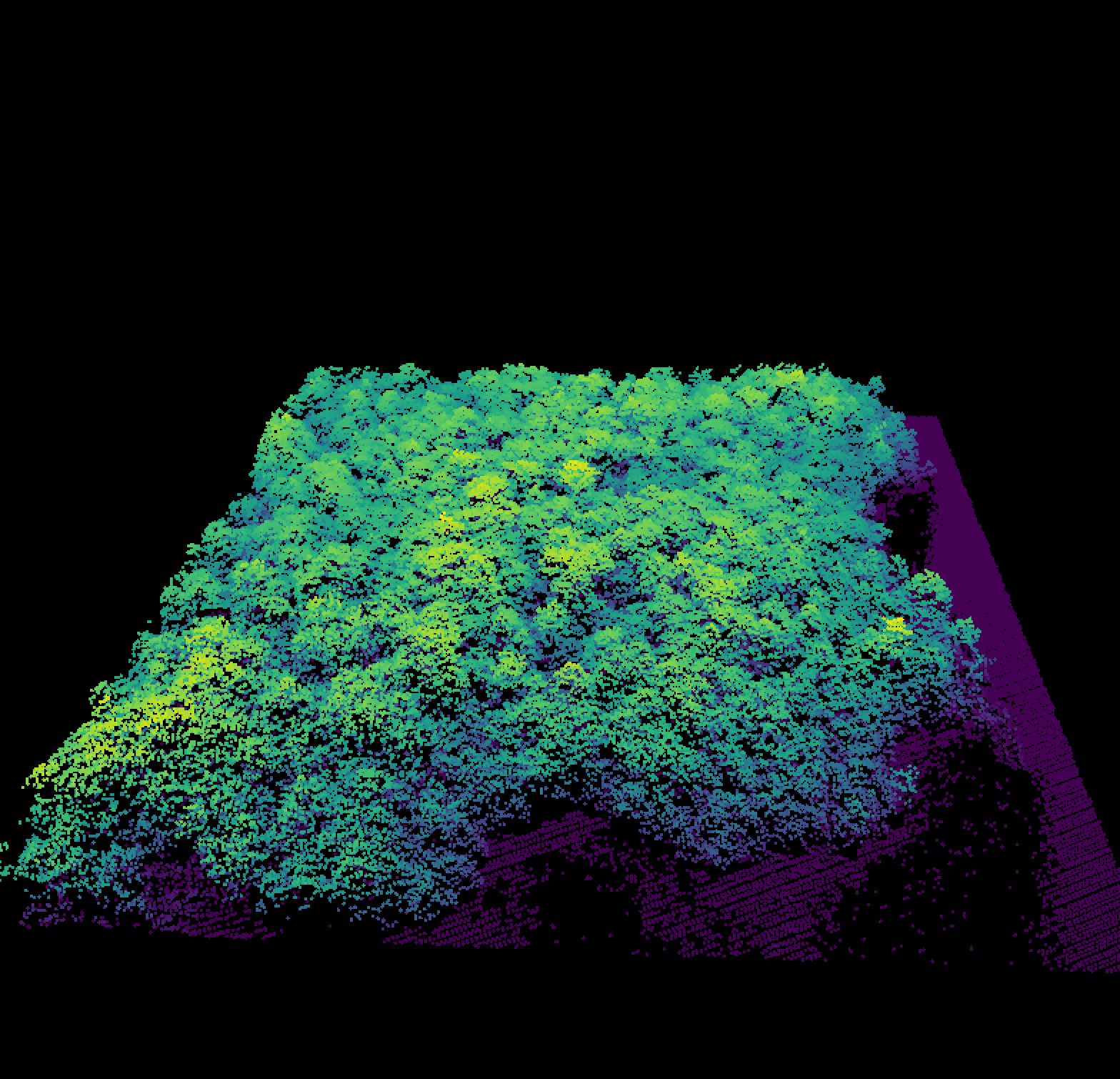
Forest Tree Crown Segmentation & Biomass Analysis
Geomatics Surveying
Please check my github repo for a comprehensive report of this project.
Read more
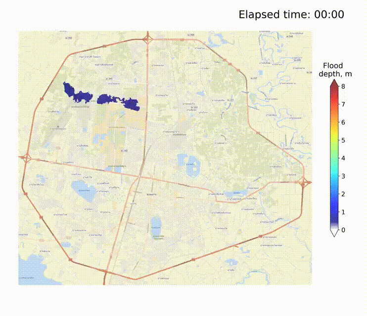
Urban Pluvial Flood Simulation
Geomatics Surveying
This simulation was developed using a numerical model based on the Shallow Water Equation.The model analyzes surface flow direction and inundation patterns under actual urban topography, driven by rainfall conditions, to assess overland flow dynamics and flood-prone areas
Read more
Solar Radiation Assessment for Panel Placement
Geomatics Surveying
This project showcases the potential of solar panel placements on rooftops by assessing zonal statistics and radiation.
Read more
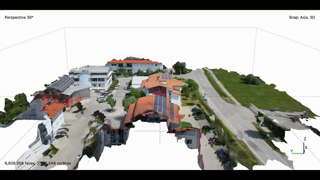
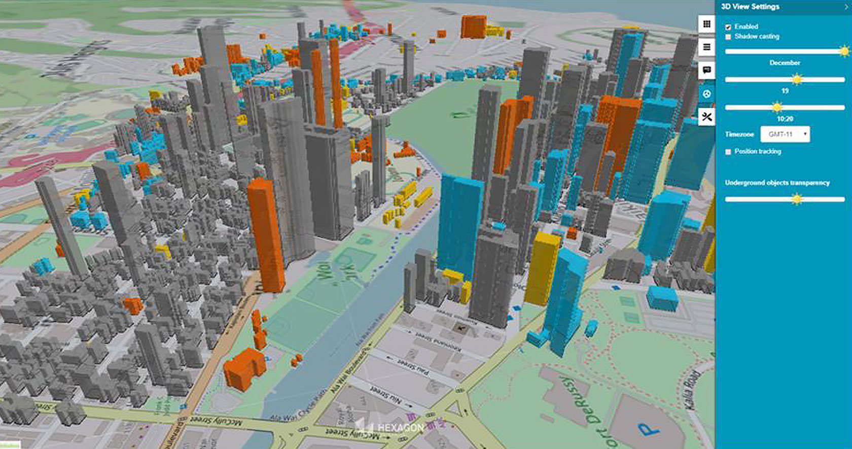
Digital Twin 3D Model
Geomatics Surveying
Please check my github repo for a comprehensive report of this project.
Read more
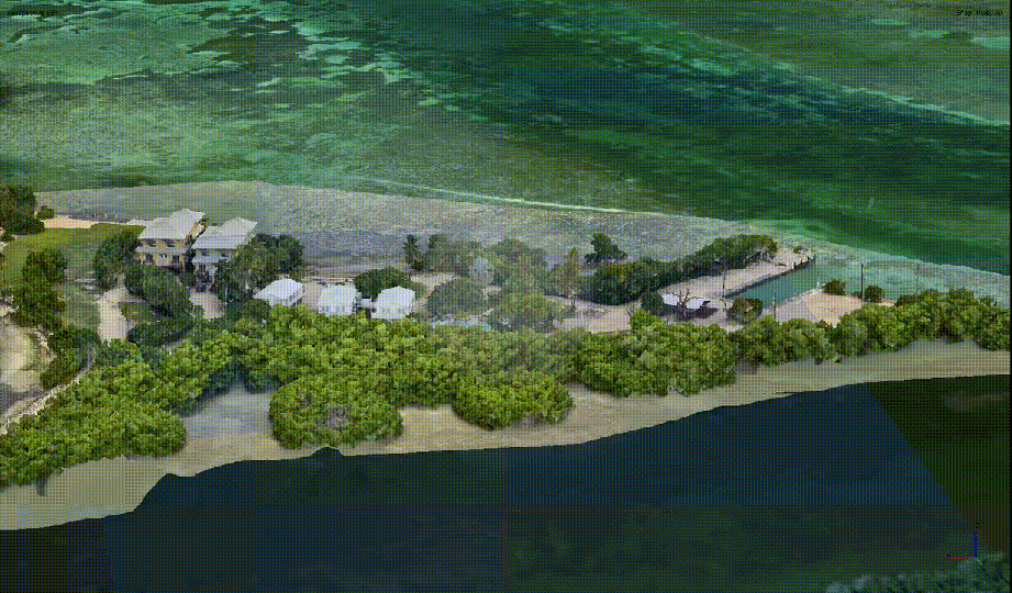
3D Model of Resort
Geomatics Surveying
Please check my github repo for a comprehensive report of this project.
Read more
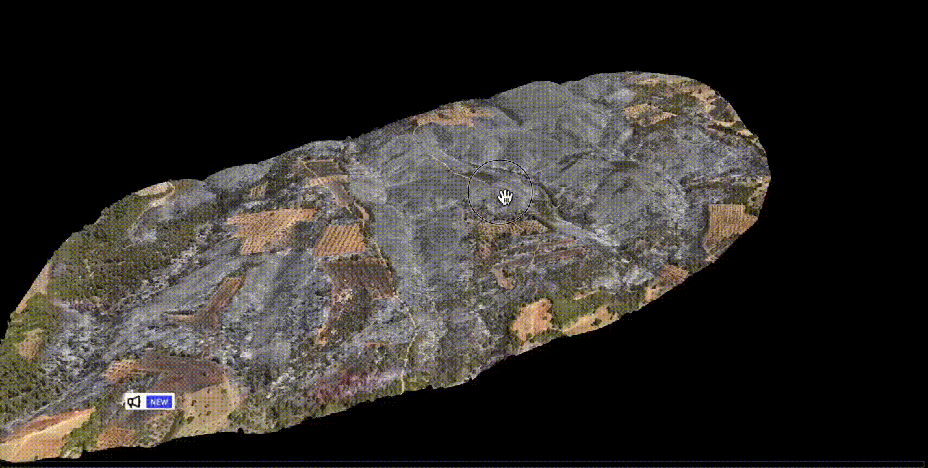
3D Model of Ranch Site
Geomatics Surveying
Please check my github repo for a comprehensive report of this project.
Read more
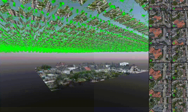
3D Model of Suburb (Austin)
Geomatics Surveying
Please check my github repo for a comprehensive report of this project.
Read more
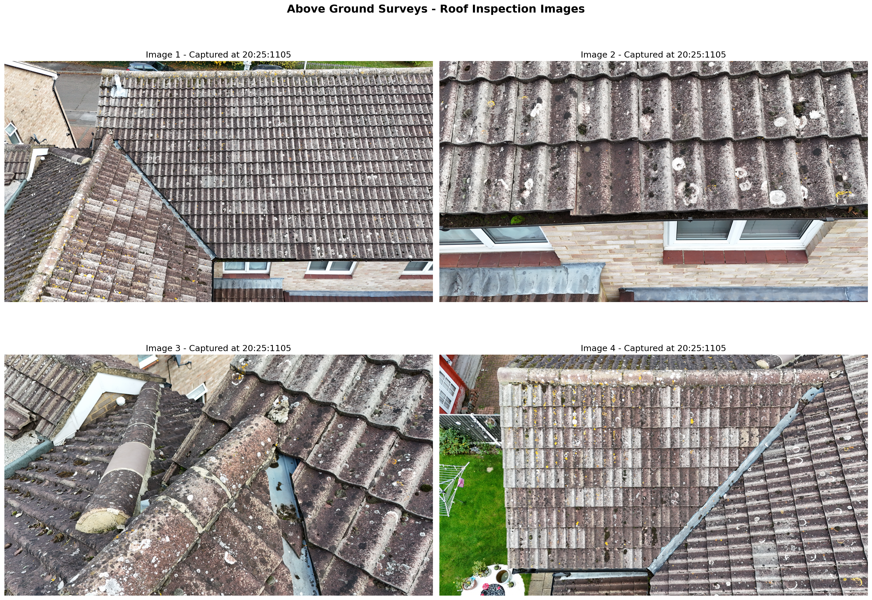
Rooftop Condition Report
Geomatics Surveying
Please check my github repo for a comprehensive report of this project.
Read more
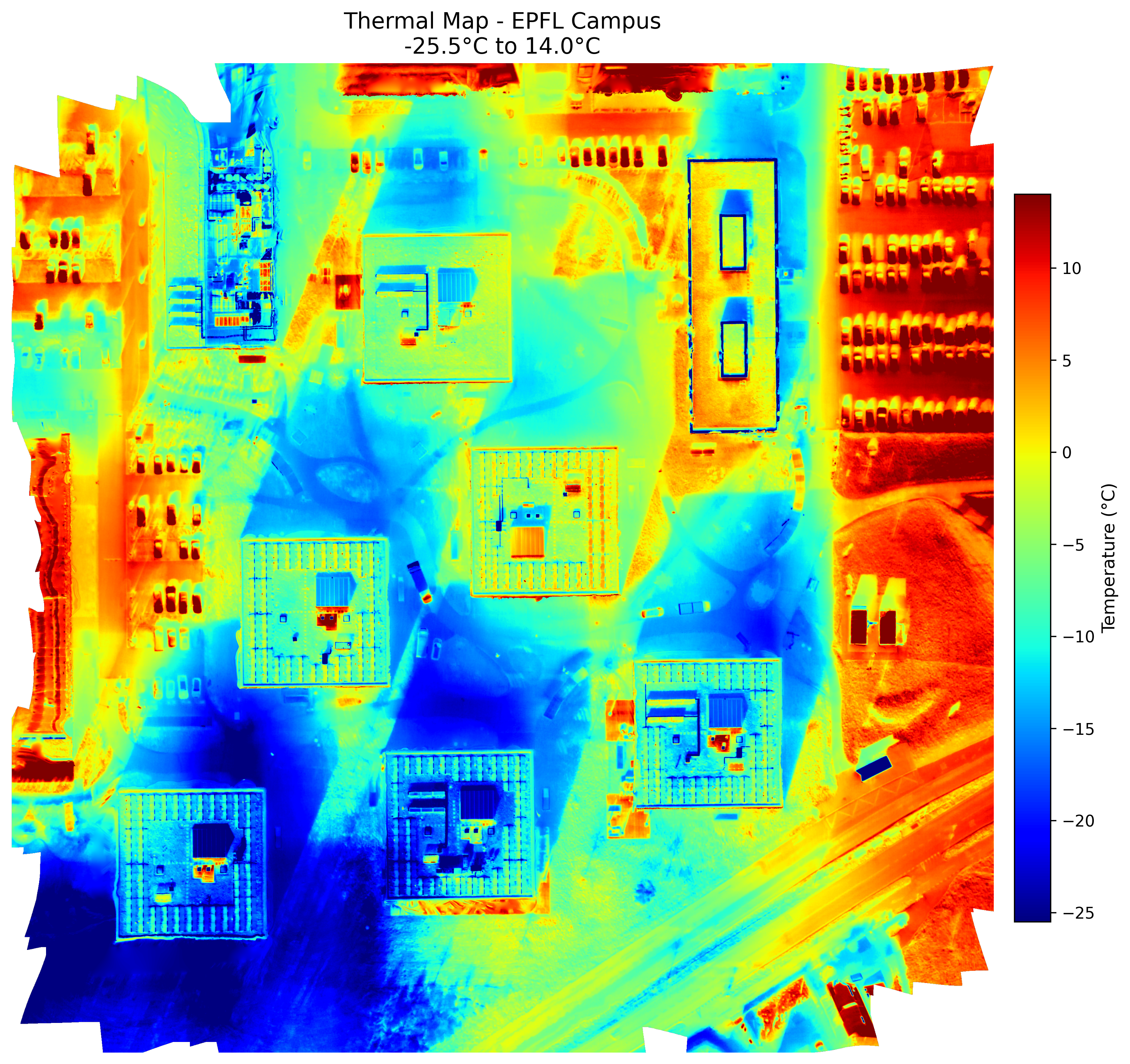
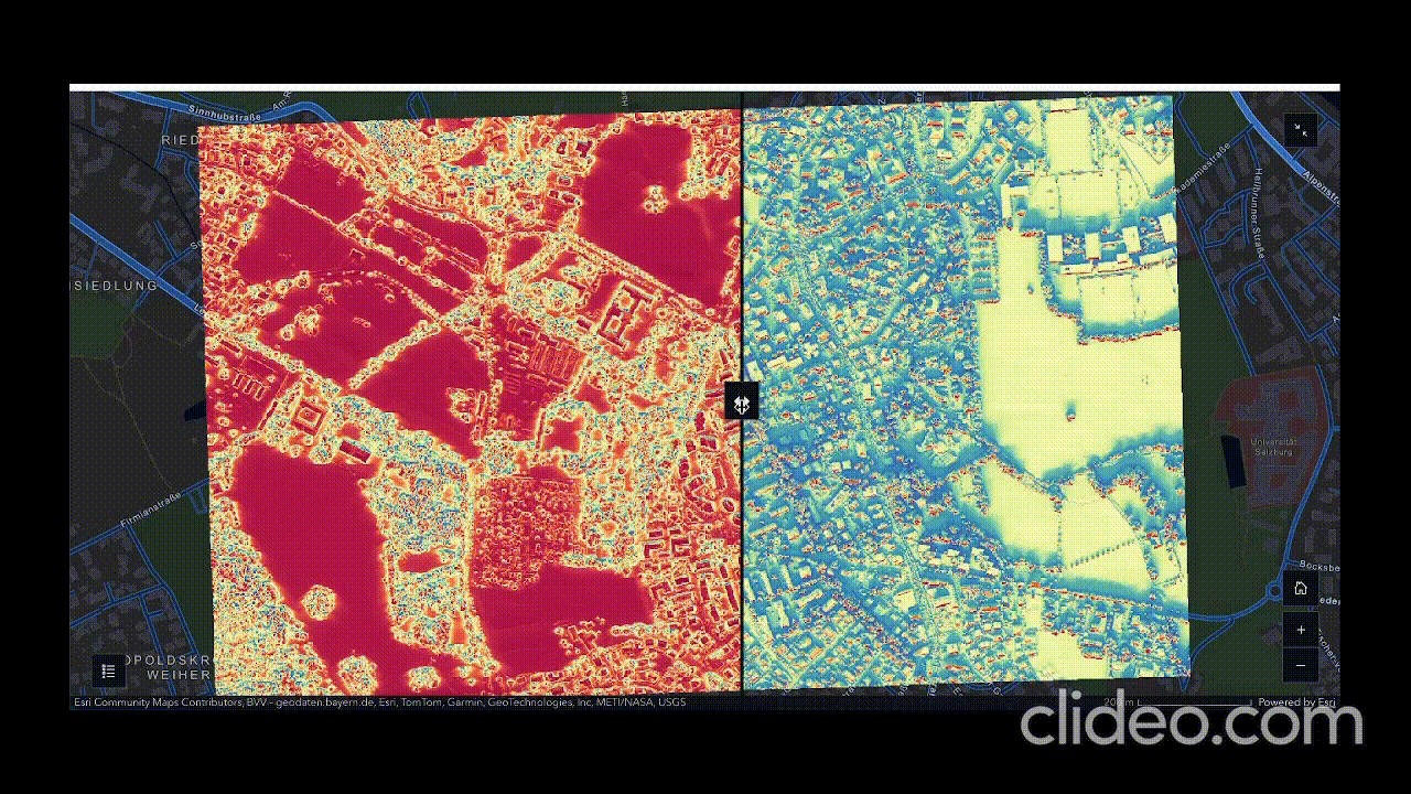
Thermal Mapping (Campus Rooftop)
Geomatics Surveying
Please check my github repo for a comprehensive report of this project.
Read more
Cartography & Visualization
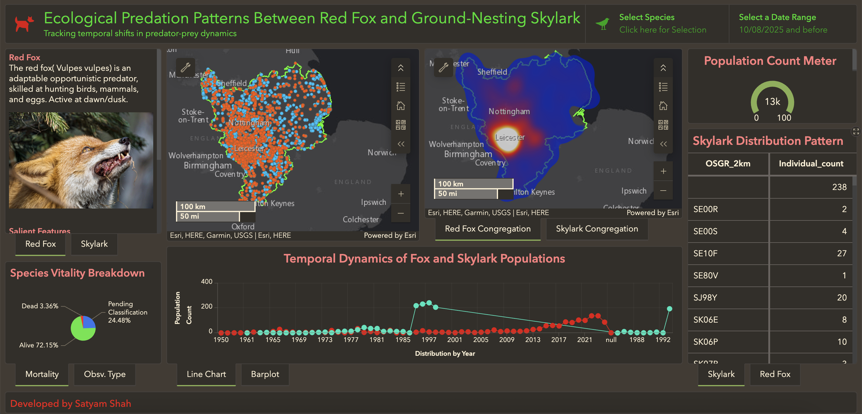
Predation Patterns of Fox and Skylark Dashboard
Geovisualization and Advanced Cartography
The dashboard shows the predator-prey temporal dynamics between Fox and Skylark.
Read more
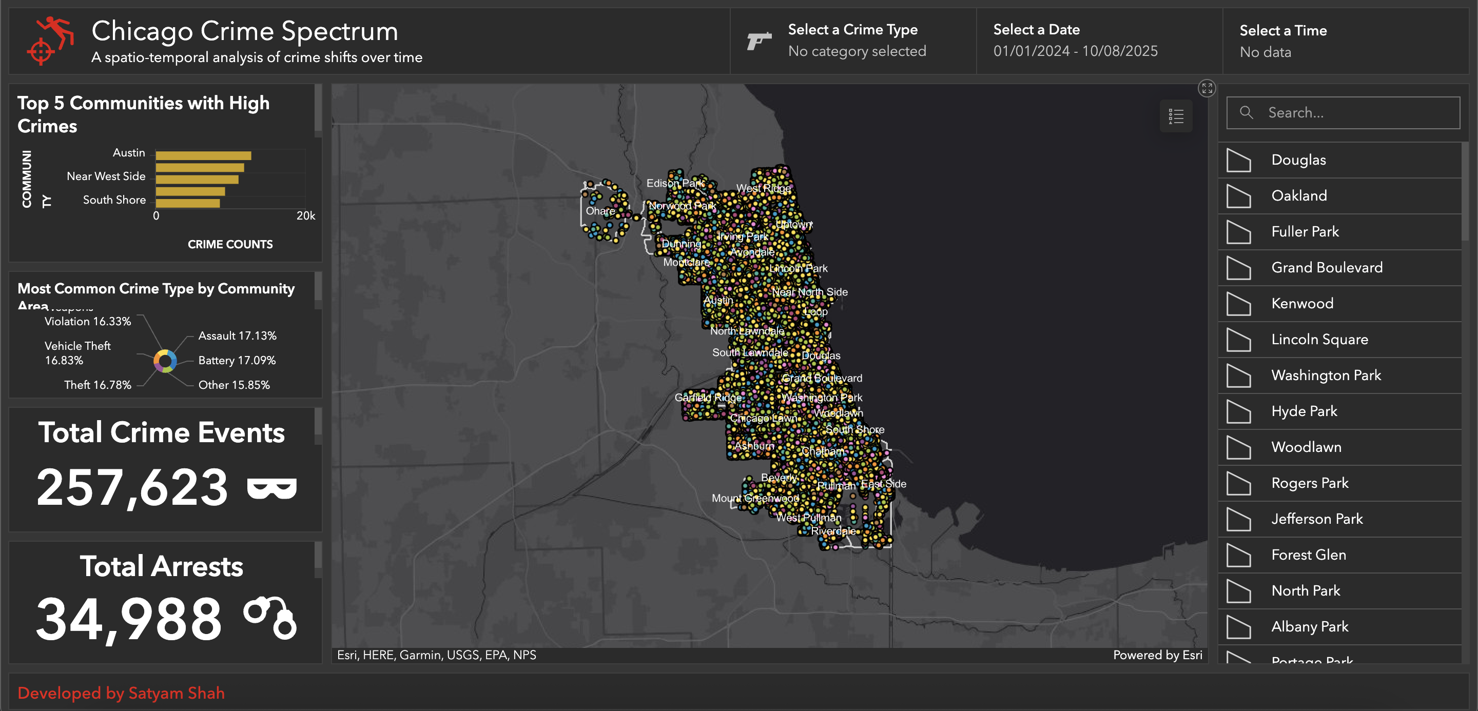
Chicago Crime Spectrum Dashboard
Geovisualization and Advanced Cartography
The dashboard shows the crime rates and distribution of crime types across community areas of Chicago.
Read more
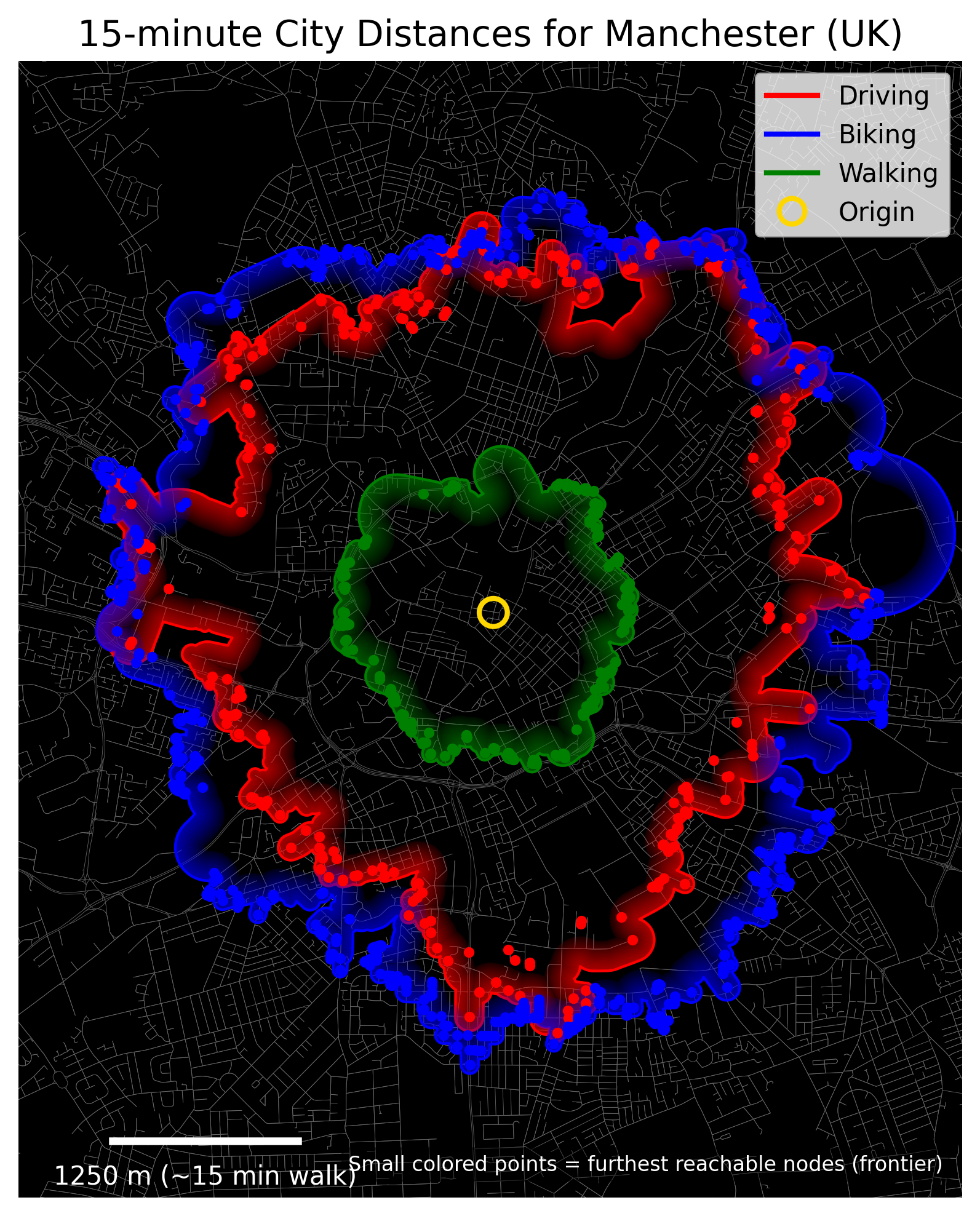
Isochrone Map of Manchester
Geovisualization and Advanced Cartography
Isochrone map depicting reachable areas within specific times for walking, cycling, and driving.
Read more
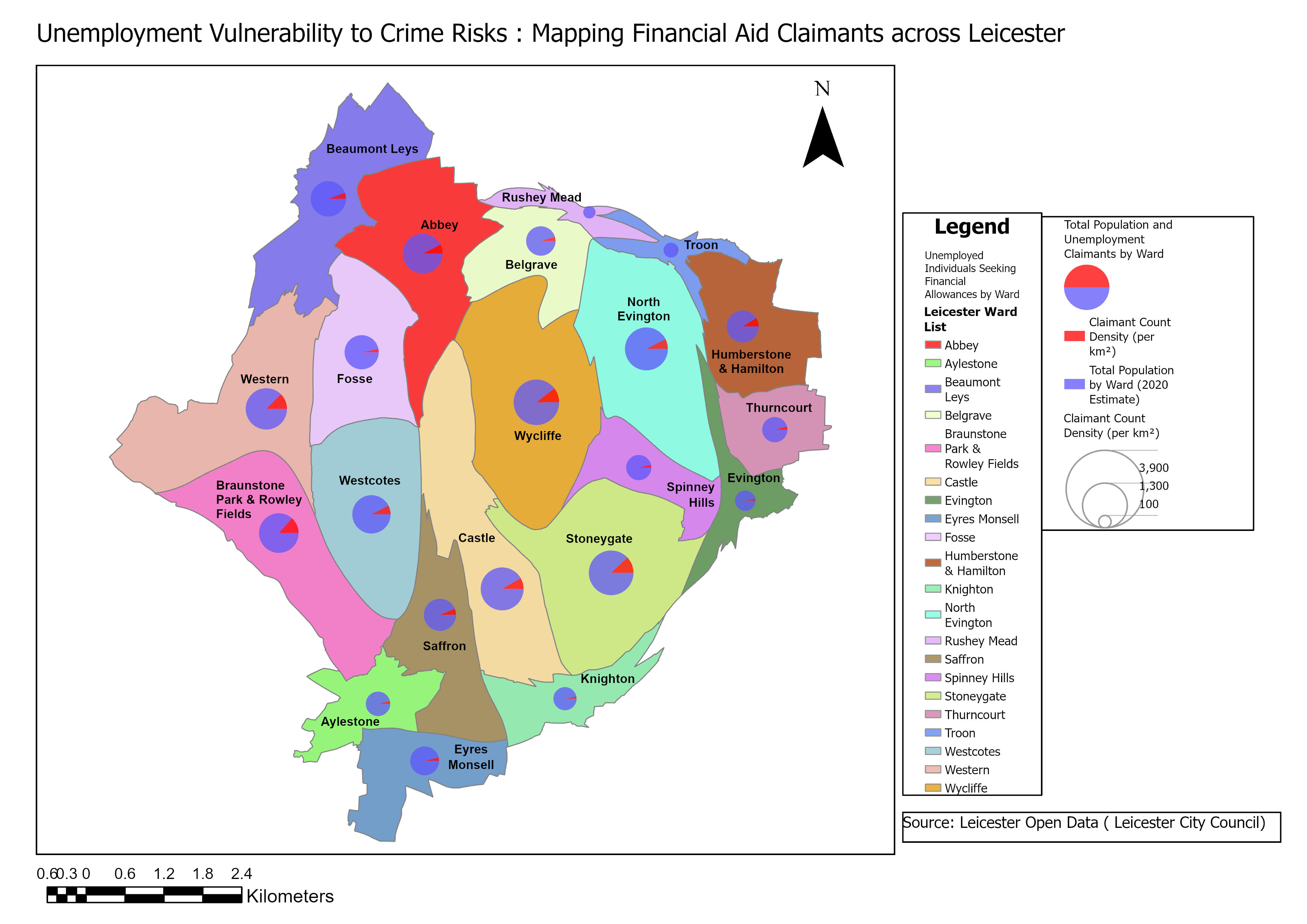
Cartogram Map
Geovisualization and Advanced Cartography
Cartogram map showing unemployment vulnerability and aid claimants across Leicester.
Read more
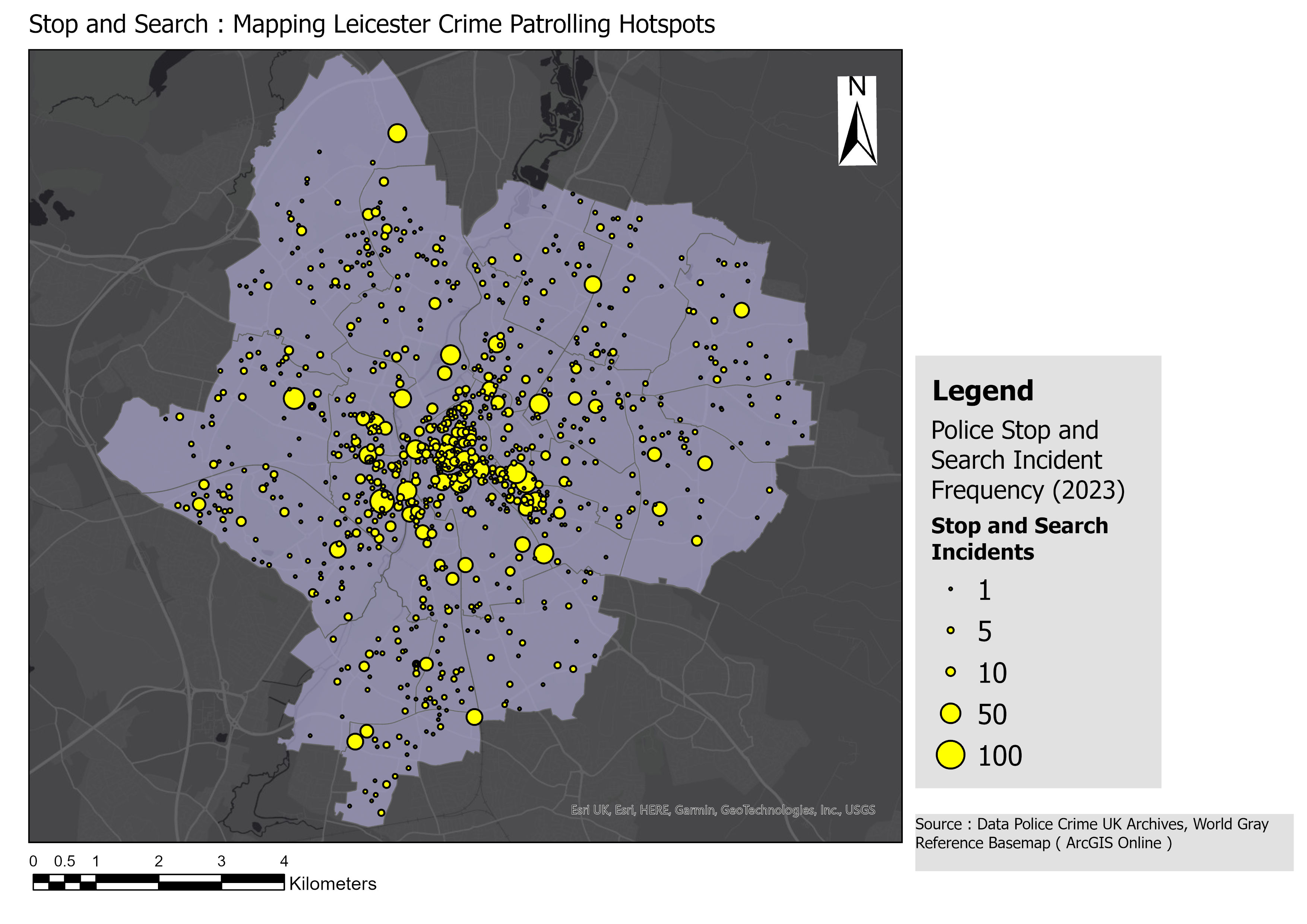
Proportional Symbol Map
Geovisualization and Advanced Cartography
This map shows stop and search patrolling hotspots across Leicester.
Read more
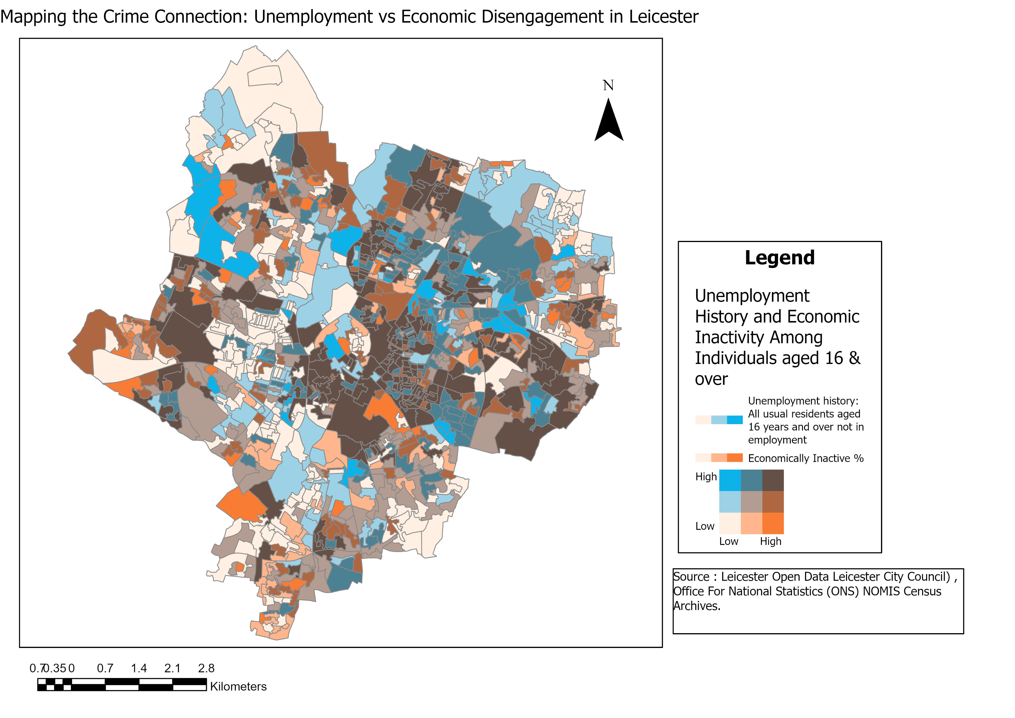
Bivariate Map
Geovisualization and Advanced Cartography
Bivariate map showing unemployment and economic disengagement across Leicester wards.
Read more
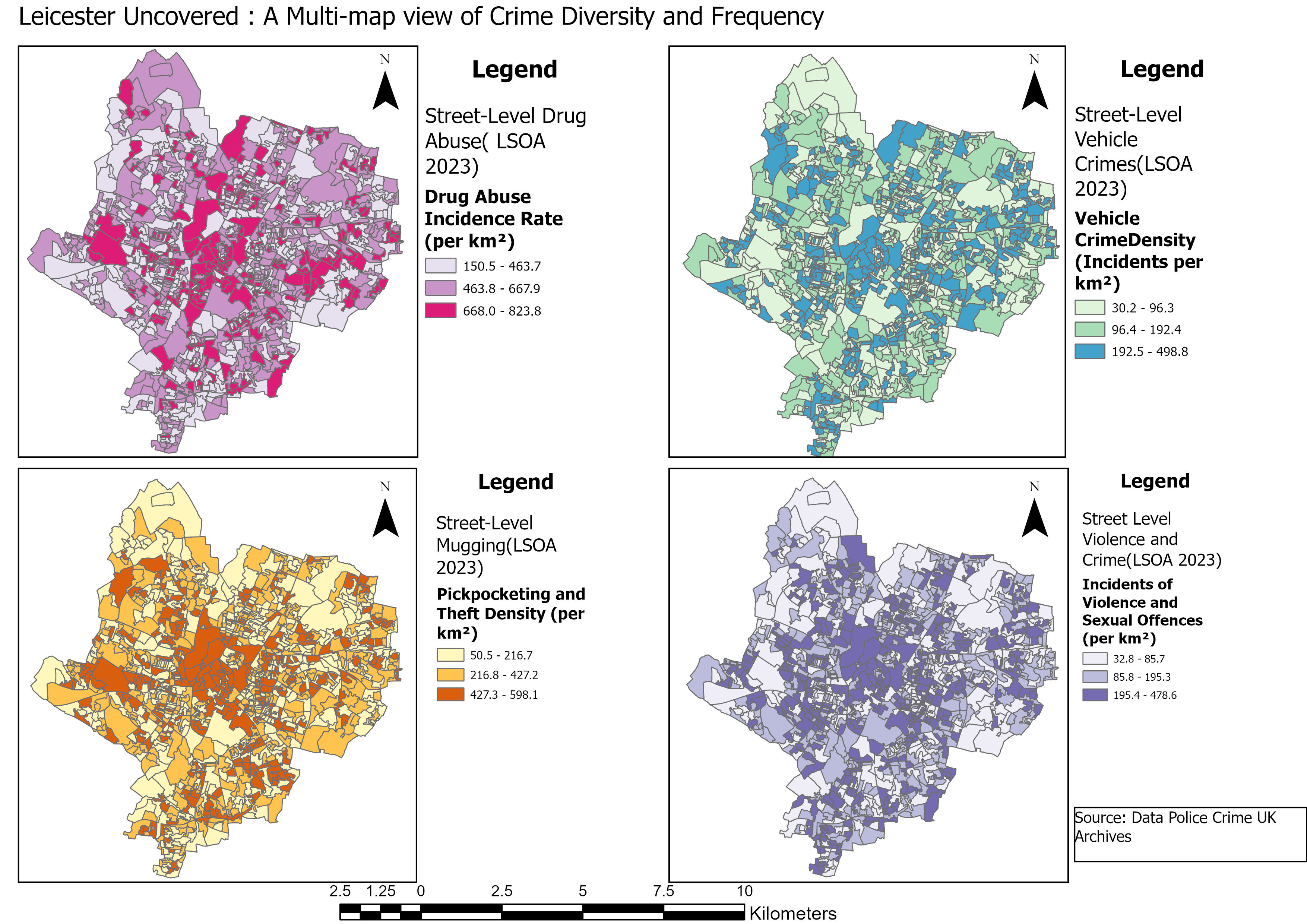
Choropleth Small Multiple Maps
Geovisualization and Advanced Cartography
This map shows the diversity and frequency of crimes across Leicester.
Read more
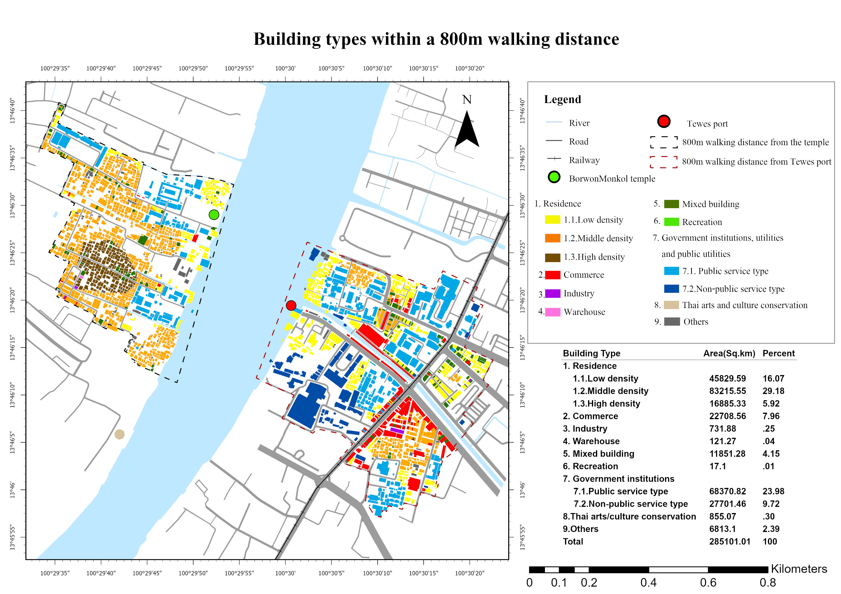
Building Types Classification
Geovisualization and Advanced Cartography
This map shows landuse around Borwon Mongkol Temple classified into 9 classes.
Read more
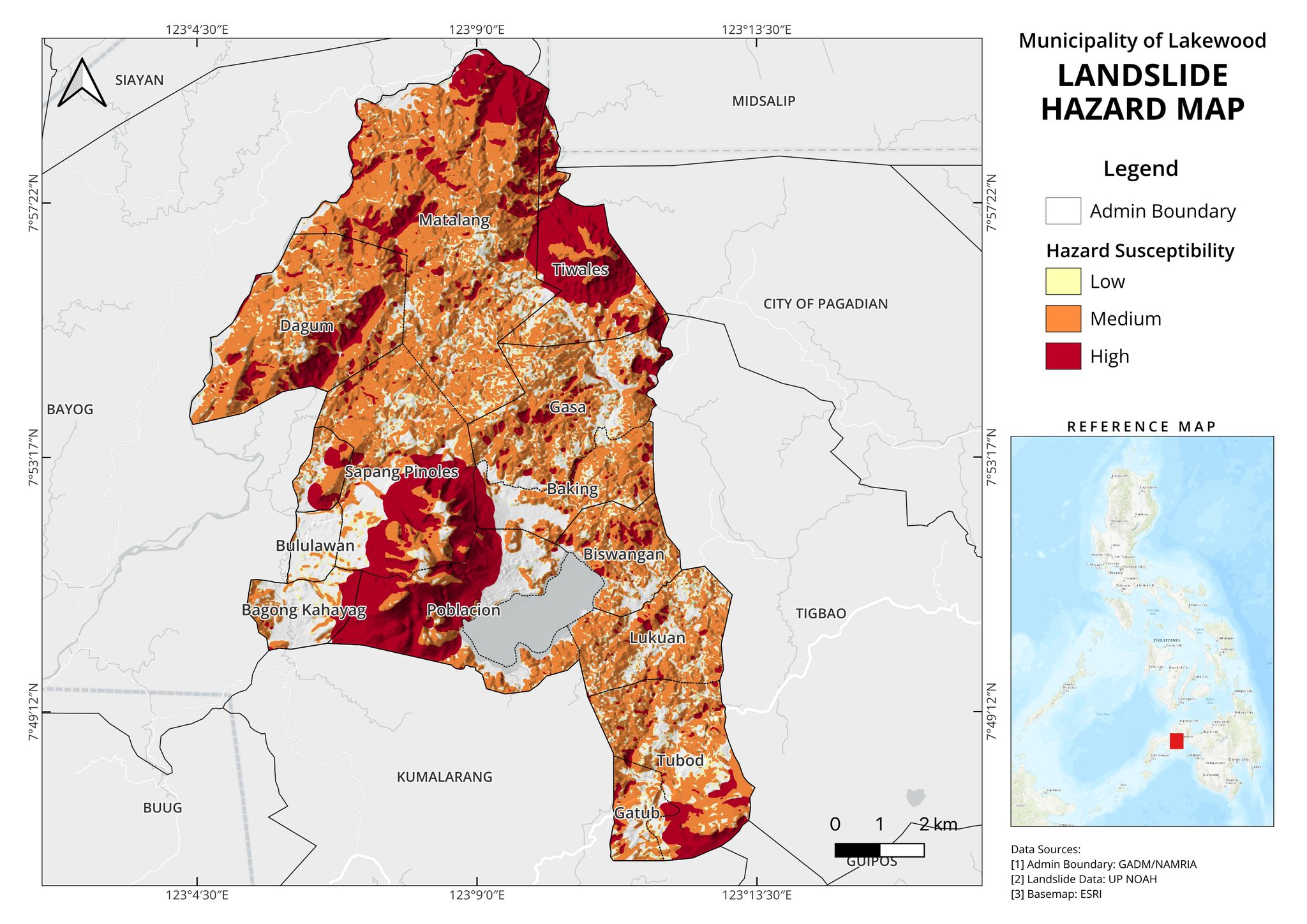
Landslide Hazard Map
Geovisualization and Advanced Cartography
This map shows landslide hazard susceptibility in the Municipality of Lakewood.
Read more
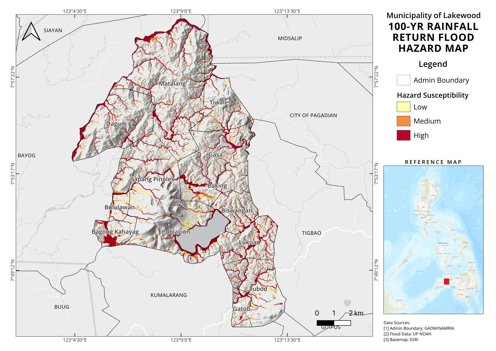
Rainfall Return Flood Map
Geovisualization and Advanced Cartography
This map shows 100-YR rainfall return flood hazard susceptibility in the Municipality of Lakewood.
Read more
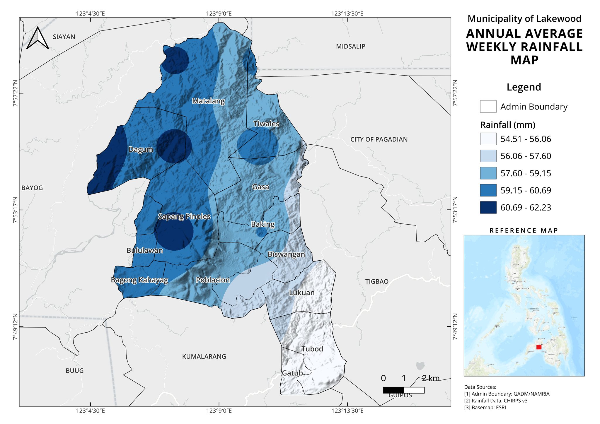
Annual Average Rainfall Map
Geovisualization and Advanced Cartography
This map shows the annual average weekly precipitation spread in the Municipality of Lakewood.
Read more
3D Terrain from Orthophoto and DEM
Geovisualization and Advanced Cartography
This 3D interactive map shows the overlaid RGB orthophoto on top of DEM to better visualize depth.
Read more
Global Internet Connectivity
Geovisualization and Advanced Cartography
This interactive map visualizes the backbone of global internet connectivity, highlighting the densest cable networks, critical coastal hubs, and regions with lower connectivity
Read more
Wind Flow Visualization
Geovisualization and Advanced Cartography
This is a high-quality wind animation showing temporal changes in wind patterns across the UK.
Read more
Global Flight Routes and Airport Network
Geovisualization and Advanced Cartography
This is a high-quality informative visualization that reveals the underlying patterns of global air travel.
Read more
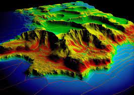
3D Land Cover Switzerland
Geovisualization and Advanced Cartography
This is a high-quality 3D LULC terrain render of Switzerland.
Read more
GeoAI (AI for Geospatial)
Developing Location-Based-Services(LBS) Application
Geographical Ai
This project consisted of making use of GR POI ranking algorithms to develop LBS system.
Read more
Publications
Assessing Ecosystem Services of Greenspaces
Zenodo
This was my undergraduate thesis looking at how we could assess the ecosystem services from greenspaces where pollinators and plants were major proxy variables.
Read paper
Multi-temporal Sentinel-2 consensus mapping framework for enhanced wildfire severity assessment in semi-arid East Africa
Research Square
Read paper
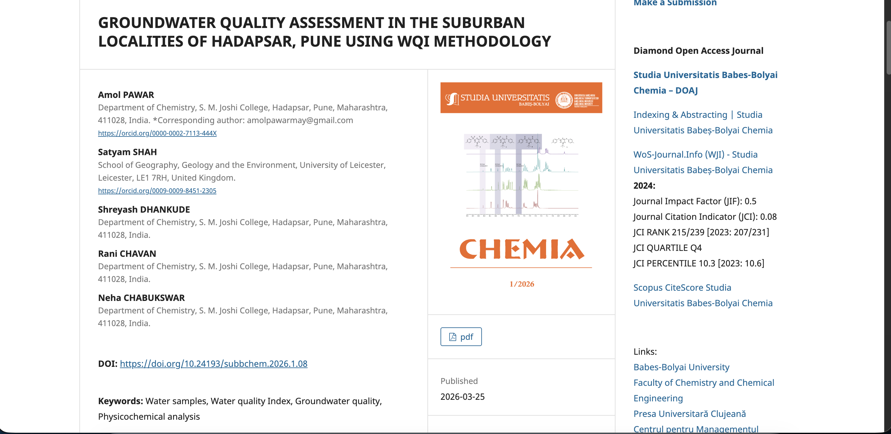
Groundwater Quality Assessment in the Suburban Localities of Hadapsar, Pune Using WQI Methodology
Studia Universitatis Babes-Bolyai Chemia
Read paper
Certifications
WebGIS:Beginner to Advanced
Udemy
View Certificate
UgCS Basics
SPH Engineering
View Certificate
Hydrologic Modeling with HEC-HMS
UNESCO
View Certificate
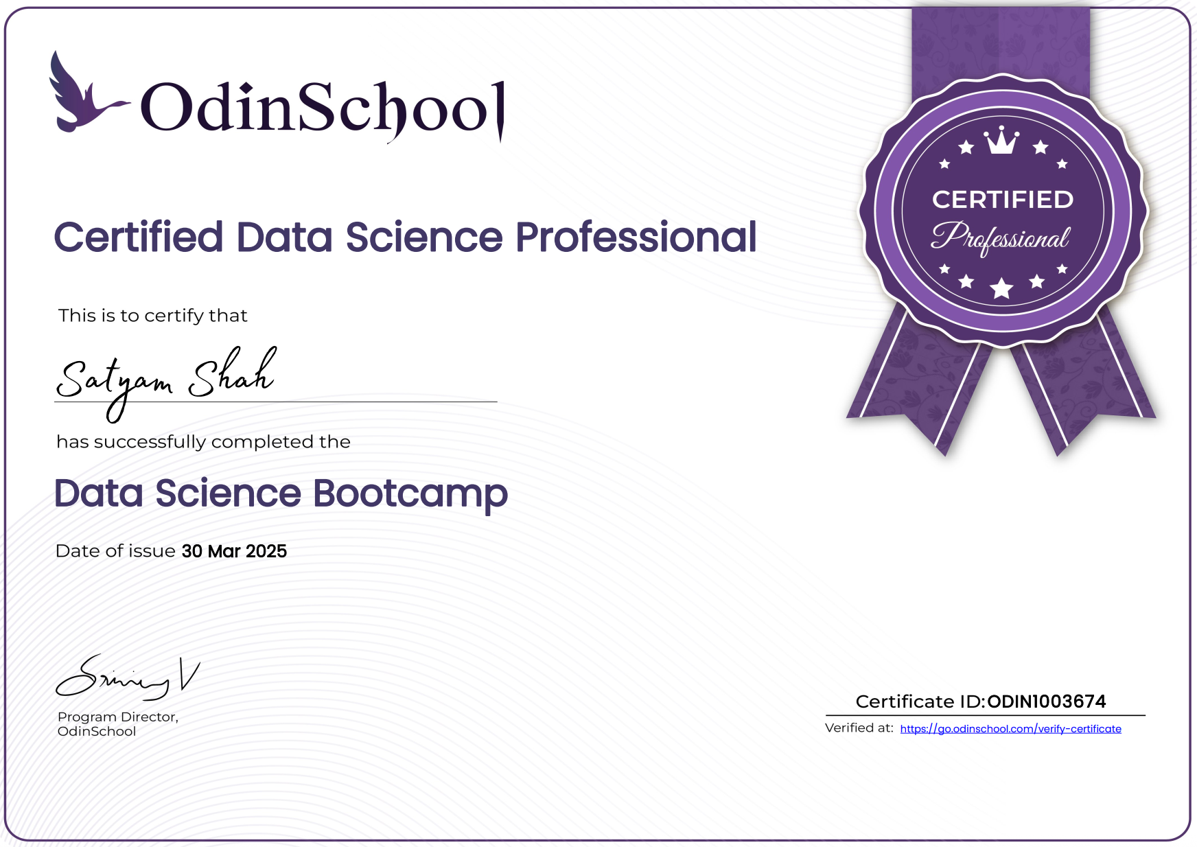
Certified Data Science Professional
Odin School
View Certificate
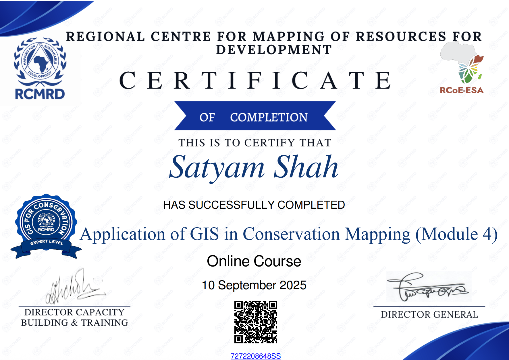
Application of GIS in Conservation
RCMRD
View Certificate
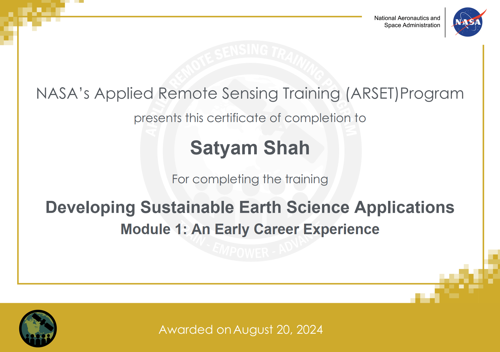
Developing Sustainable Earth Observation Applications
NASA ARSET
View Certificate
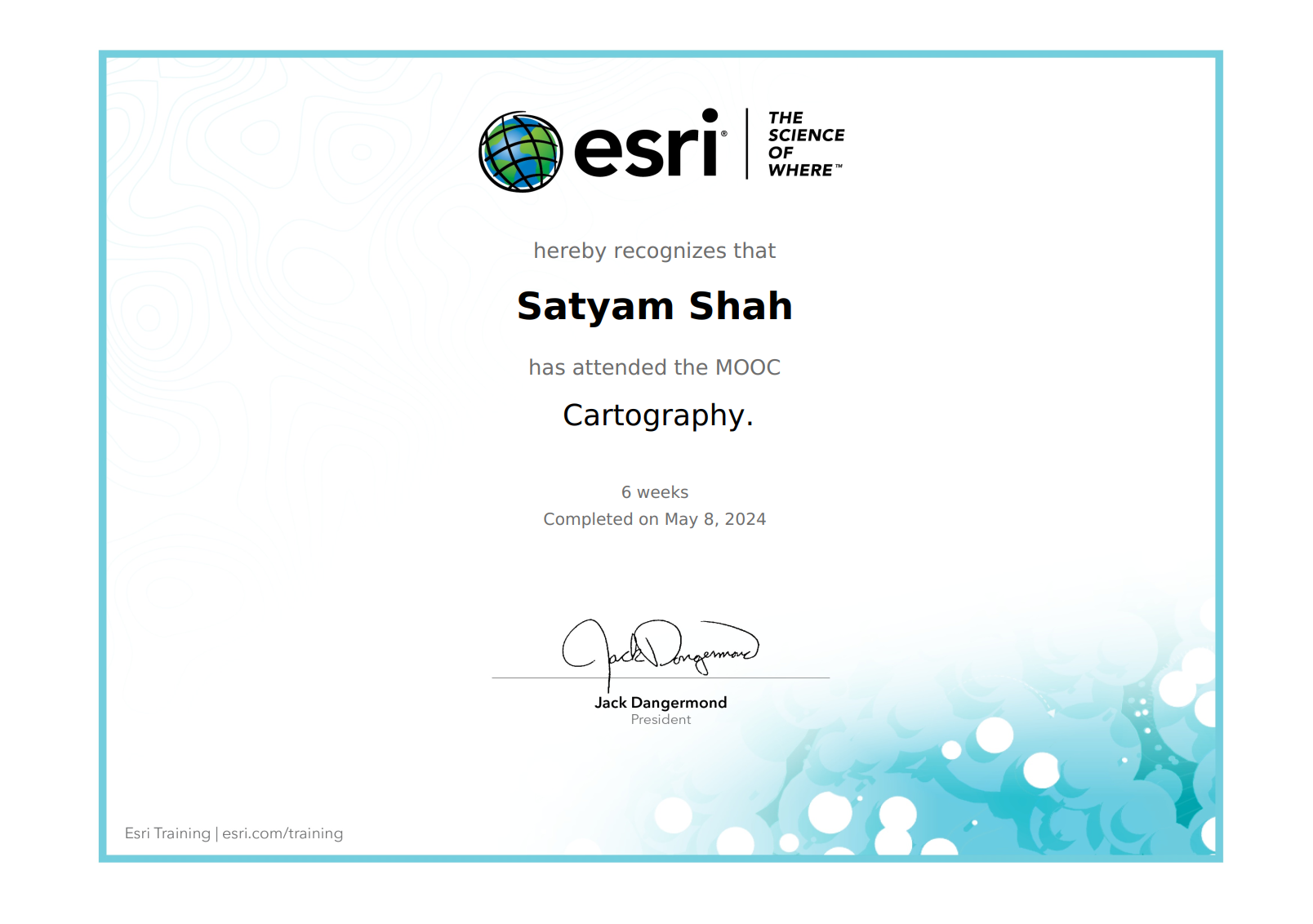
Cartography
ESRI
View Certificate
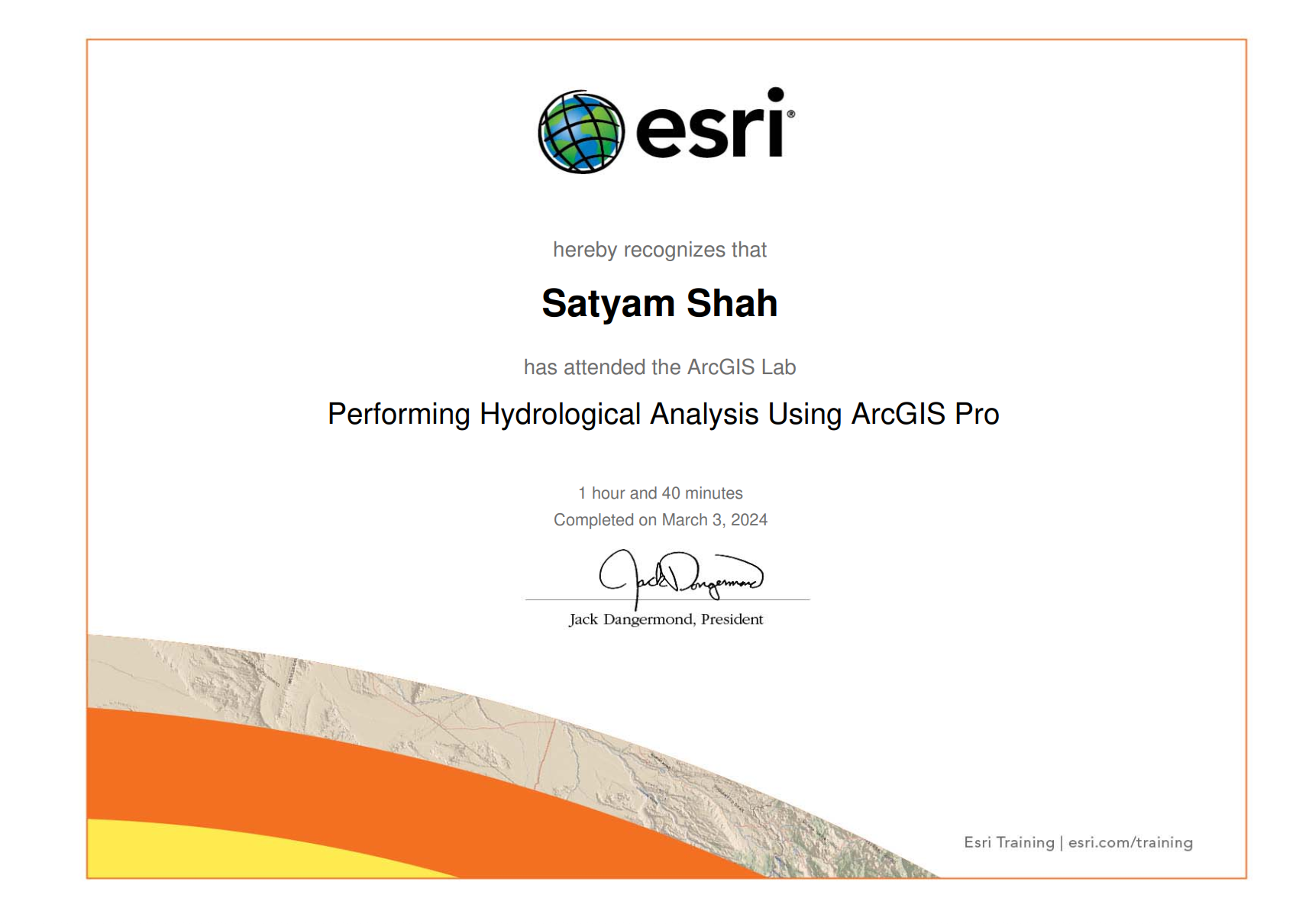
Hydrological Modelling
ESRI
View Certificate
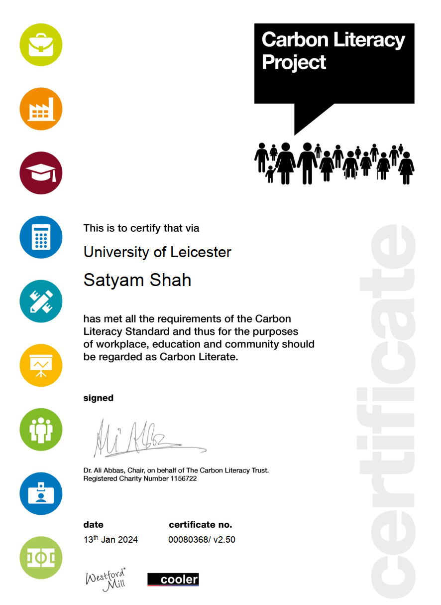
Carbon Literate
Carbin Literacy Project
View Certificate
Achievement & Awards
Gatsby Plant Science Program Grant
I was one of a few students from top UK universities awarded a prestigious grant to attend the highly competitive GPSEP.
Read more
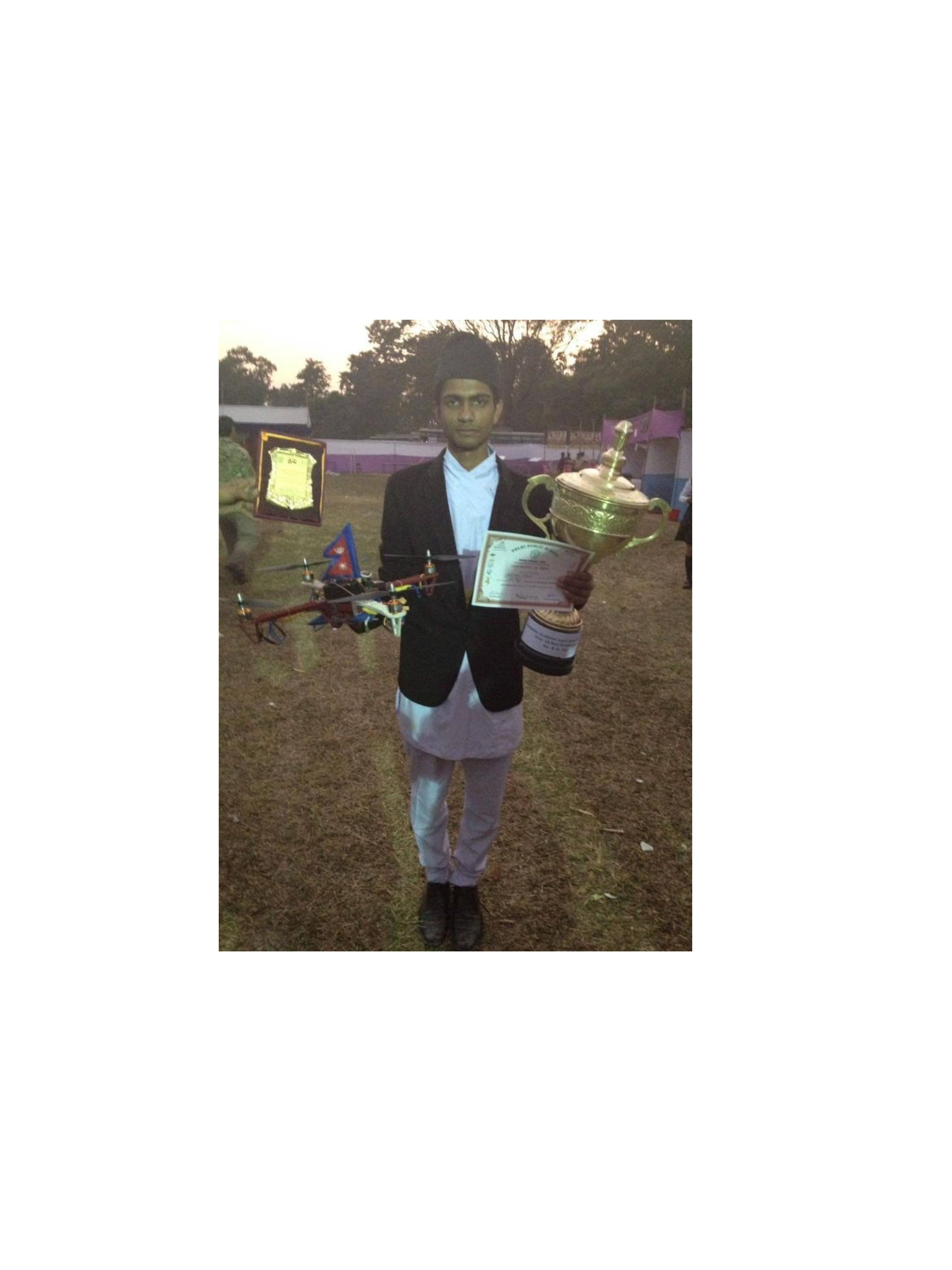
Modular Custom UAV
I was awarded 1st Prize upon developing a modular custom drone capable of picking and dropping payloads.
Read more

STEMist Hack2.0
Leicester Gold Award
Awarded the prestigious Leicester Gold Award for academic excellence and significant extracurricular engagement.
Read more

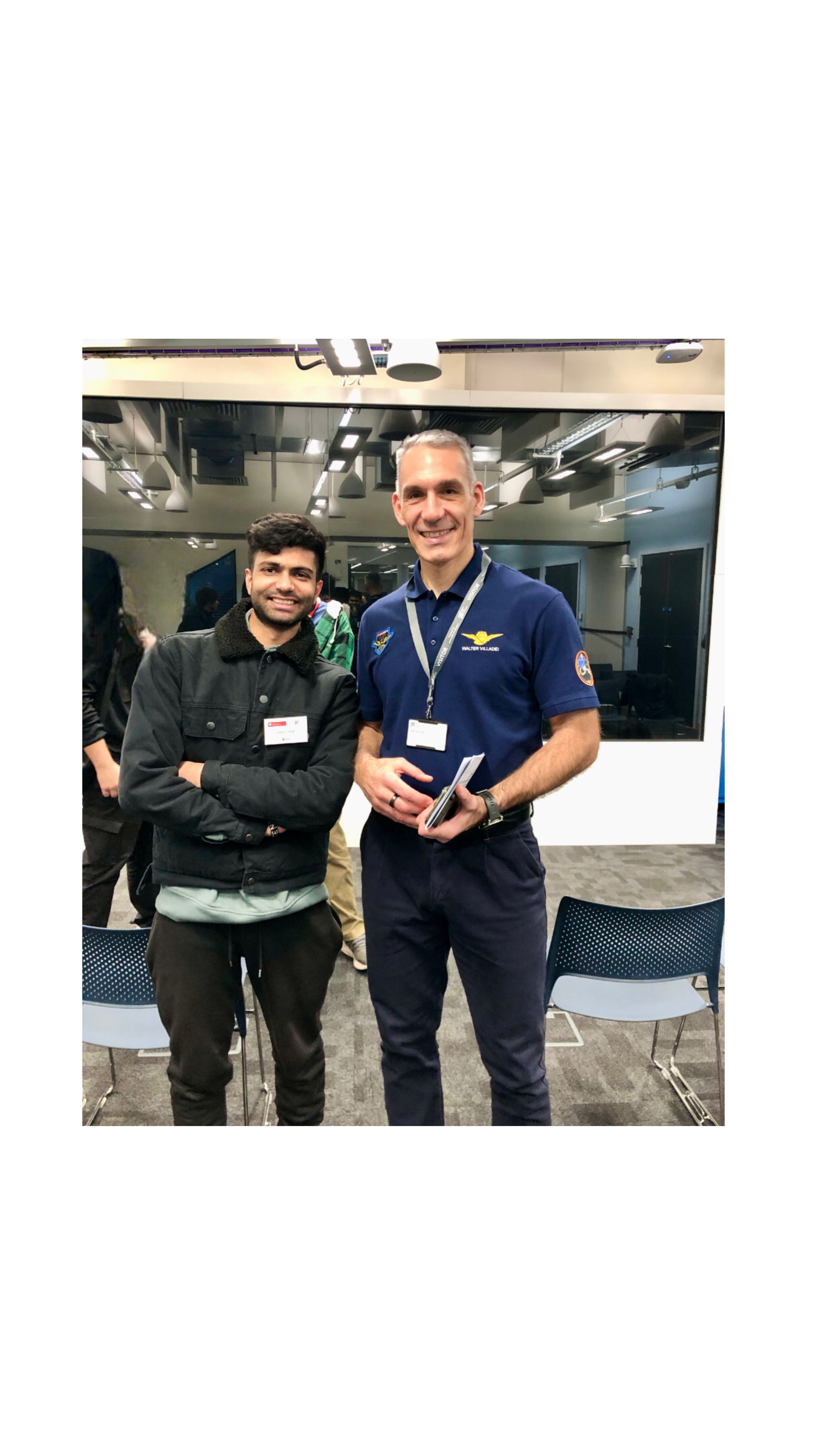
Uk Space Conference 2019
I was awarded a prize for outperforming competitors in a technical simulation of docking a Soyuz spacecraft to the International Space Station
Read more
Services
Geospatial Analysis
Spatial statistics, spatial modelling, site suitability, geoprocessing and map production.
Remote Sensing
Satellite & UAV imagery processing, land-use mapping, change detection and feature extraction.
Cartography & Visualization
Publication maps, interactive web maps and data storytelling with Mapbox / Leaflet / D3.
Geospatial Data Science
Machine learning, predictive modelling, object detection and automated geoprocessing pipelines.
Field Surveying & Data Capture
GNSS/GPS surveys, UAV flight planning & acquisition, total station support and ground truth collection.
3D Mapping & Point Clouds
SfM photogrammetry, LiDAR/TLS processing, point-cloud classification, DEM/DSM and 3D reconstruction.
Web Maps & Dashboards
Interactive dashboards, web mapping apps, geospatial APIs and cloud deployment for visualization/monitoring.

Research Support & Consultancy
Study design, manuscript/data analysis, reproducible workflows, training and technical reports.